Using river water- what’s permitted?

People are naturally very concerned when, during a drought and a hosepipe ban, they see pumps operating to abstract water from the River Cam or its chalk stream tributaries. We have had a number of queries about this over this summer, so this blog aims to provide some answers.

Current legislation states that an individual or a business may “abstract” (i.e. remove) up to 20 cubic metres of water a day from a river, stream, lake, or underground source – equivalent to 20,000 litres or 4400 gallons/day, whether that’s from a single place or several different places on the same river or stream. Above that amount, a licence from the Environment Agency is required.

As Rob Bakewell, of the Environment Agency, has explained to us:

Licence specific details will include how much water can be taken, when it can be taken, where it can be taken, and for what purpose. We monitor river water levels and flows via telemetry from sites around East Anglia, including along the River Cam. My team monitor these Monday to Friday and inform licence holders when they can and cannot take water, based on conditions designed to protect river wildlife and habitats. Water levels in the River Cam and its tributaries are currently low due to a dry spring, and some licences have seen temporary reductions in abstraction, but abstraction is currently still permitted. This can change depending on how river levels and flows are affected by weather conditions. Environment Agency teams are currently reviewing and renewing abstraction licences in the area. This is a rolling programme where we review abstraction in our catchments. This includes checking that water use is environmentally sustainable.”

Legislation requires that abstraction licence holders from all sectors must submit annual returns detailing how much water they have taken. The Environment Agency encourages licence holders to do this using their online Water Resources Licensing Service. Returns data are checked to ensure water has been taken according to the licence conditions. Although there have been cases of farms breaching their permits, Rob Bakewell says that in our region nearly all licence holders take water legally and, if any discrepancy is noted, the EA regulatory teams investigate and take appropriate action.

The Environment Agency’s 2020 Cam and Ely Ouse Abstraction Licensing Strategy sets out how abstraction is managed.

If you suspect someone is taking water when they shouldn’t, or to report an environmental problem, please call the Environment Agency’s 24/7 incident hotline on 0800 80 70 60.

Here are two examples of abstraction, that we’ve been asked about

Trumpington Farm Company

Cam Valley Forum has received several queries in relation to a pump that has been operated by Trumpington Farm Company, near a popular spot on Grantchester Meadows, below the Red Lion Pub, Grantchester.
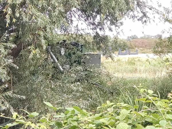
The irrigation pump, half hidden by a tree

Rob Bakewell of the Environment Agency has explained to us:

“Trumpington Farm Company holds four abstraction licences that allow them to take water from parts of the River Cam, Granta, and Rhee. At this time of year, the company uses the water to irrigate crops. Their licences allow them to move pumps along certain stretches of the rivers, rather than taking water from one fixed location, so pumps may be placed wherever the water is needed. This can mean that other river users may see and hear abstraction pumps operating, as part of normal farming activity.”

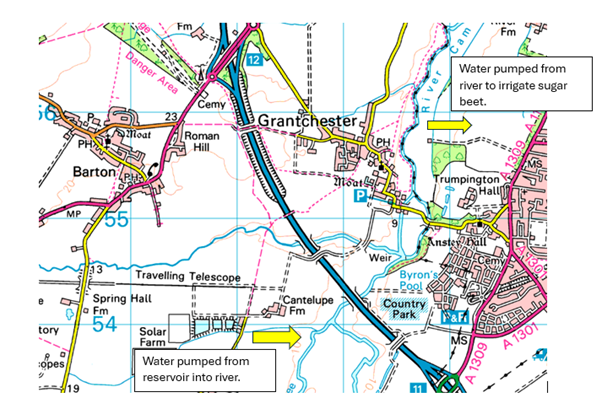
We have also discussed this with the Dave Knott, the farm manager for Trumpington Farm Company.  He explained that they have a large network of storage reservoirs, pumps and pipes, and that they also use the rivers to transfer water. Part of this network is shown on the map below.

Map of water transfer from Reservoir to a downstream field

Their reservoirs near Cantelupe Farm are refilled during wet weather and can hold 32 million gallons of water to use when the weather is dry.  To our surprise they told us that they are currently (in August 2026) pumping this water INTO the river, as a way to transfer it to where it’s needed.  They then pump slightly less back out again, further downstream where they need it to irrigate crops: in this case, near Grantchester (opposite Red Lion meadow).

The water that people have noticed being pumped out of the Cam at this spot is being pumped through a network of pipes up to a field nearer to Trumpington Road, where it is being used to irrigate sugar beet. 

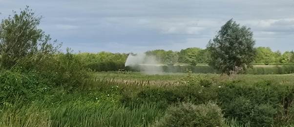
The irrigation in operation,, visible one evening from Grantchester Meadows

We were reassured to hear that they aim to put 110 litres into the river, for every 100 litres they take out of the river. It seems that Trumpington Farm Company is behaving according to the regulations, and we are pleased that they realise the importance of maintaining and even trying to increase the flow of the Cam during the drought.

They tell us that they try to only operate the pump at night, because that’s a more efficient way to use the water, but sometimes they’ve also needed to operate it during the day. 

This statement may seem puzzling to those who walk along the river, who have observed the pump in operation during much of the daytime throughout June and July. However, the heat really has been exceptional, and is very worrying; Dave Knott, the farm manager, tells us that the sugar beet is really suffering. He says “It looks like it’s been ironed”.  He is also worried about next year’s harvests, as they should have started planting two weeks ago, but the hard and dry ground has prevented this.

Cherry Hinton and the Blacklands Allotments

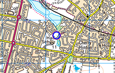
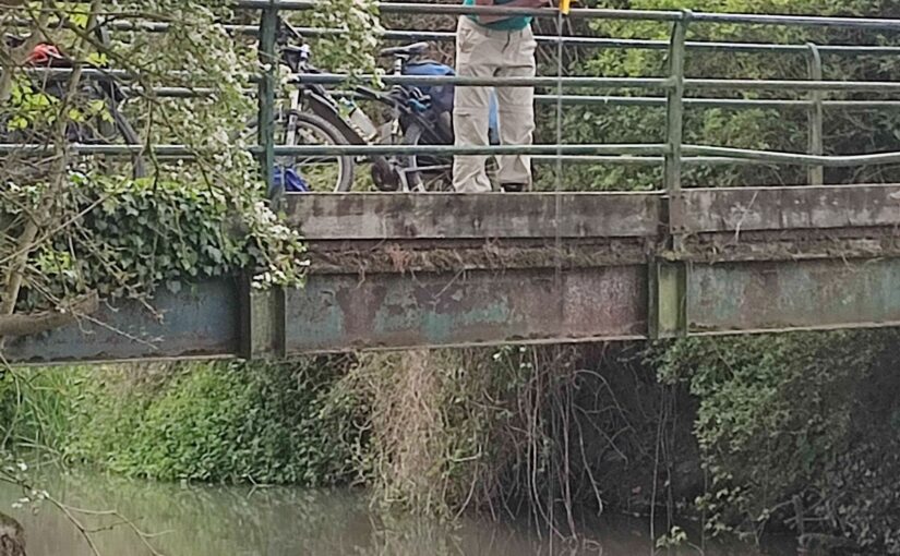
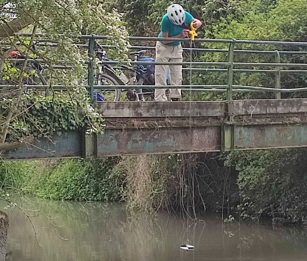
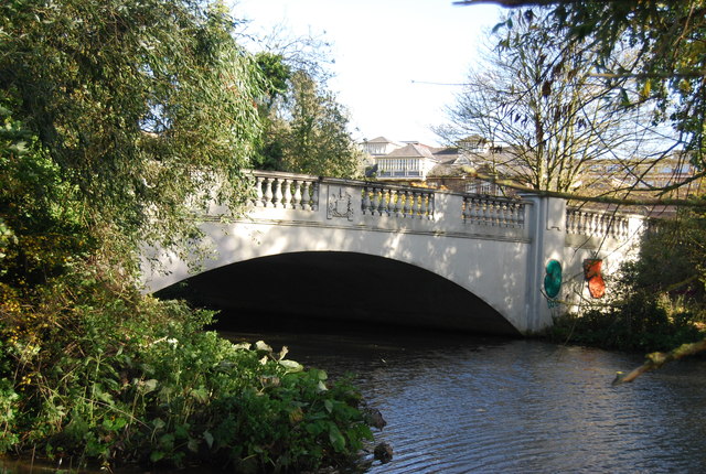
This year, as in all previous dry and drought years, there have been numerous complaints and queries about the pump that is seen operating frequently, including at night, on the bridge across Cherry Hinton Brook, at the entrance to Blacklands Allotments (at the Daws Lane end of Snakey Path, near Cherry Hinton Hall).   

The Blacklands Allotments, along with the adjacent banks of Cherry Hinton Brook, belong to Peterhouse College. Local residents can rent a plot.  As a ‘riparian’ owner, Peterhouse (through its allotment holders) is allowed to abstract 20,000 litres a day from the brook, without a licence.  However, the allotment holders together must not exceed the total amount of 20,000 litres a day to which Peterhouse is entitled.

For many years (reportedly since the mid-1960s), certain plot holders have used a pump to abstract water into tanks to use by themselves and for other plot holders.  In both 2012 and 2014, the Environment Agency was contacted about this practice and in both cases, following inspection, the plot holders were told there was no objection.  Unlike many council-owned allotments, there are no water pumps or troughs providing water for plot holders to use, and relatively few plot holders appear to have their own rainwater harvesting systems.  Nevertheless, the pump does not send a good message about the vulnerability of Cherry Hinton Brook during the drought; in previous years, sections have indeed dried out and the level is dropping quite rapidly at the moment.

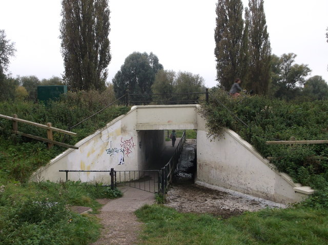
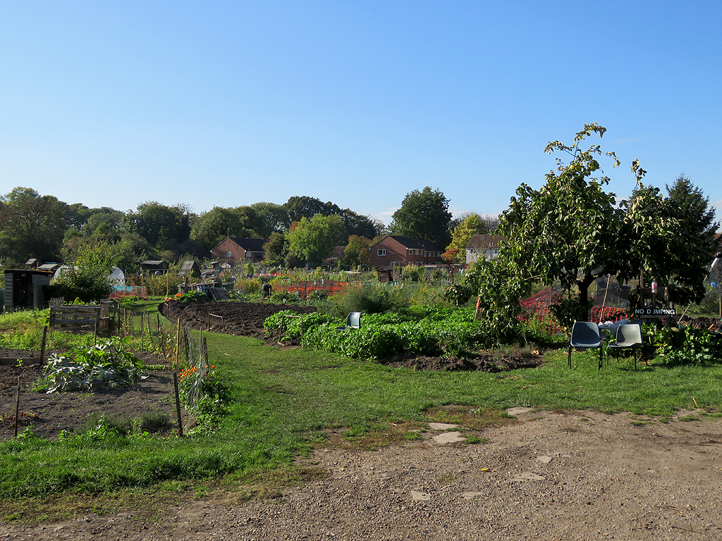
Blackland Allotments, when at their best!. Photo by John Sutton, Geograph

Allotment holders are struggling with this long dry period.  Many have already exhausted their stored water; others have not had the means or resources to install water storage.  

Friends of Cherry Hinton and Coldham’s Brooks (FCHCB) are working with local allotment holders, with the local Council and all involved to increase publicity about the importance of the City’s chalk streams and to encourage allotment holders to minimise their use of brook water wherever possible.  We are also looking at ways of helping plot holders to install water harvesting systems so that in the future they will have better access to stored water, without needing to use the brook.

Sylvia Haslam ScD Cantab. 1934-2026

Sylvia Haslam ScD Cantab. 1934-2026

It is with sadness that we announce the death at the age of 91 of Dr. Sylvia Haslam who was a Life Member and longstanding supporter of the Cam Valley Forum. She will be best known to CVF members as the co-author, in her retirement, with the late fellow CVF member Tina Bone, of their ‘River Friend’ series of books. Details of these can be found here. Various reviews of the series are included on our website here .   The final book in the series, Book 9, was published last year and focuses on the River Cam.

Sylvia was a distinguished botanist who researched aquatic macrophytes, river ecology and fluvial landscapes across Europe. Howard Griffiths, recently retired from the Cambridge Dept. of Plant Sciences, has written admiringly of her extensive work including the landmark 1975 publication (with co-authors C A Sinker and P A Wolseley) of ‘British Water Plants’. He spoke of being taken by Sylvia to the headwaters of the Granta and Rhee ‘searching for Chalk stream macrophytes from which we hoped to characterise Rubisco kinetic properties as a function of their contrasting leaf carbon uptake strategies’. (Rubisco being that vital enzyme that all plants employ to remove carbon dioxide from the environment!)

Dr. Haslam generously left funds to establish a Tripos Part II prize in Plant Ecology when she moved from Cambridge to Somerset to be closer to her family. After a funeral service in Taunton she was buried in the churchyard of St. Andrew and St. Mary, Grantchester in July.

Sylvia expressed her despair at the declining state of rivers, not least the Cam. An inveterate long-hand letter-writer Sylvia was sharp to the end.

DB

Bathing Water Timetable

Timetable for investments to improve the bathing water quality at Sheep’s Green

Here is our understanding of the current timetable for improvements to the Sewage infrastructure in the Haslingfield area, based on our regular meetings with the Environment Agency and Anglian Water

This investment programme is aiming to improve the water quality from “Poor” to at least “Satisfactory”. It is a direct result of having achieved Designated Bathing Water status for the Cam at Sheep’s Green in May 2024

May 2024-Nov 2024. Bathing Water designation, initial monitoring and classification.

The Environment Agency started monitoring Sheep’s Green for E.coli, resulting (as we expected) in a classification of the Bathing water Quality as “Poor”. This then triggered the requirement for work to improve it.

May 2025-April 2027. Investigations and Source apportionment study

Anglian Water and the Environment Agency are currently carrying out a major investigation into the causes of the poor bathing water quality. This is a major programme of work, for which Anglian Water have budgeted around £500K. Anglian Water are investigating the contribution from their assets (sewage works, pipes, pumping stations etc), while the Environment Agency is also investigating other potential causes, such as from agriculture.  Both have put sensors (data sondes) in the river at various points, which are monitoring the state of the river 24/7 (we analyse some of the results here). The Environment Agency is also continuing to monitor E.coli at Sheep’s Green, weekly during the bathing seasons, and monthly during the rest of the year. (Our commentary on the results from 2024 and 2025 is available here)

We are also contributing our local expertise and data.  In particular we’re concerned about the impact of the unusually high turbidity in the Rhee and Cam (which reduces the natural degradation rate of bacteria by sunlight)

30 April 2027  The “obligation date” for Anglian Water to provide the Environment Agency with a report on results of their investigations into the causes of the poor bathing water quality.

We are calling for the Environment Agency to make this public, once they have received it in April 2027

30 April 2028  The “obligation date”  for Anglian Water have to have completed the improvements to Haslingfield sewage works “identified through the investigation”, including the reduction of storm overflows. We know they are expecting to install significantly bigger storm overflow tanks, but may include other measures too.

Reducing overflows should help significantly, because we are told the area has a problem with ingress of ground water. Currently Haslingfield Sewage Works is overflowing around 25% of the time

31 March 2030. The “obligation date”  for completion of improved phosphate removal at Haslingfield Sewage works. This is not required for bathing water, but very beneficial for the health of the river.

2030-2035.   Completion of other measures.  If (as we hope) the study recommends major improvements such as UV treatment, we are told it may not be possible to complete this before 2030, so it would be done during the AMP9 “Asset Management Plan” budget period (which is 2030-2035) Anglian Water tell us they have budgeted up to £30M for improvements

When will see see improved Bathing Water Quality?

When the improvements are implemented, we hope to see the levels of E.coli improve quite rapidly, particularly in wetter weather. However, as the formal classification is based on the previous 4 years classifications, we are warned that it may take some time before the formal classification improves from “Poor” to at least “Satisfactory”

Welcoming the hosepipe ban

Cam Valley Forum welcomes first local hosepipe ban in over 30 years, announced by Cambridge Water and Anglian Water. But a long-term sustainable water supply and healthy chalk streams will require much more than hosepipe bans
FOR IMMEDIATE RELEASE 12th July 2026

The Cam Valley Forum welcomes Cambridge Water’s decision to introduce the first hosepipe ban in more than 30 years, having long campaigned for the company to use this tool in periods of drought [1].
We have always thought that hosepipe bans would play a useful role, not only to reduce water use but also to raise public awareness of the water crisis” says Michael Goodhart, who leads our water saving team. “However, at Cam Valley Forum’s annual meetings with Cambridge Water, the company previously always made the point that they did not consider such bans to be as effective as other methods of reducing demand.”

In a welcome change of heart, the company now says that hosepipe bans are indeed highly effective and can lower demand by about 5% (or 5 million litres a day).  In recent weeks, during the hot weather, demand has exceeded 112 million litres a day, which is a 30% increase and the equivalent of an extra 300,000 baths every day [2].

As the Environment Agency pointed out earlier this week (9th July), the series of heatwaves and lack of rain have meant that, throughout England, soils are drier than average and river flows and groundwater levels are declining [3].  Locally, ponds are starting to dry out and our chalk streams are starting to be affected.

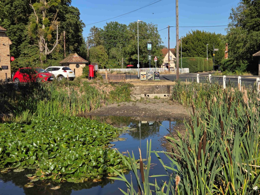
Barton Pond drying out July 2026

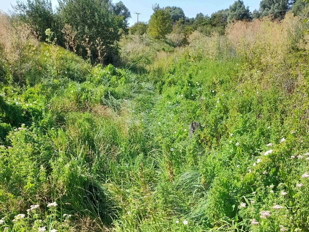
The upper reaches of the Little Wilbraham are now dry, with the lower reaches maintained only by Teversham Sewage Works, which has a continuous effluent outflow [4].

Little Wilbraham river, July 2026

Many other water companies have now also introduced hosepipe bans [3], recognising that these will help to ensure that water is available for other key purposes: for drinking and washing, for farmers to grow our food, and for rivers and our internationally important chalk streams, along with their wildlife, to thrive. Every time we turn on the tap, we are taking water from the same chalk aquifer that supplies all these needs.  The wider Cambridge area is particularly susceptible.  Cambridge Water is the only UK company which obtains all its water from an underground aquifer.  The planned Chatteris reservoir, which will mean rainwater and surface run-off can be collected, will not function until the mid-2030s, assuming it is approved.

Cam Valley Forum has every sympathy with local residents who may be incensed by the new regulation, given the negative publicity nationally about the mis-management of water.  Improvements were needed many years ago.  Leakage of pipes still accounts for 14% of total water usage in the Cambridge area [5] and is made worse by the hot weather and climate change which causes clay soils to shrink and pipes to then crack. Cam Valley Forum is urging the public to report leaks immediately to Cambridge Water [6].
We must however recognise how wasteful the British public is when it comes to water use. Cam Valley Forum is encouraging residents to collect and use rainwater wherever possible, recycle waste water (e.g. from washing up and baths), and avoid taking water directly from local chalk streams. Hosepipes can use up to 1,000 litres of water an hour –the same as a family of four uses normally in two days, or around seven full bathtubs [7].
We also want to see businesses, local councils and both universities take a more proactive role in providing technical support, funding and other help to local residents to address the water crisis. Furthermore, plans and proposals for the future development of the city and its surroundings are, at present, running counter to the urgent need for sustainable water management and we will continue to highlight this.  Cambridge Water, local authorities, businesses, farmers and local communities need to work together to improve water resilience and ensure sustainable water management for both us and the rivers and chalk streams that depend on them.

ENDS

For further information: info@camvalleyforum.uk

NOTES

  1. Cam Valley Forum’s campaign for hosepipe bans: https://camvalleyforum.uk/wp-content/uploads/2025/06/CVF-water-press-release-June-2025.pdf; https://camvalleyforum.uk/cambridge-water-reject-plea-for-a-hosepipe-ban/
  2. https://www.cambridge-water.co.uk/news/cambridge-water-announces-temporary-hosepipe-ban-to-protect-water-supplies-and-local-chalk-streams/
  3. https://www.gov.uk/government/publications/dry-weather-and-drought-in-england-2026-summary-reports/dry-weather-and-drought-in-england-2-to-9-july-2026
  4. https://www.thewrps.org/post/l-wilbraham-river-dries-up-again
  5. E-mail from Cambridge Water in response to a query from Cam Valley Forum
  6. https://www.cambridge-water.co.uk/incidents/report-a-leak
  7. https://www.cambridge-water.co.uk/household/temporary-hosepipe-ban/temporary-hosepipe-ban-faqs/

Bourn Brook Balsam part 3

Volunteers have been busy, since the contractors last cut the meadow on 26 May

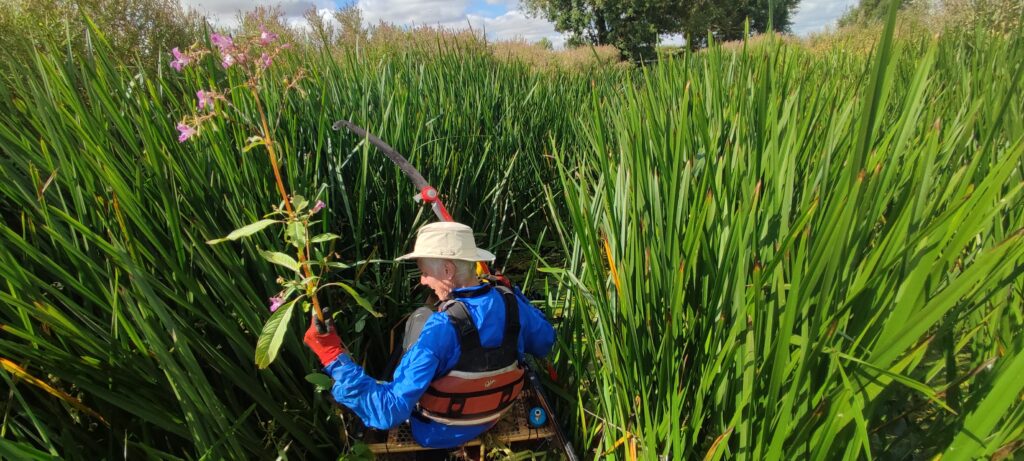
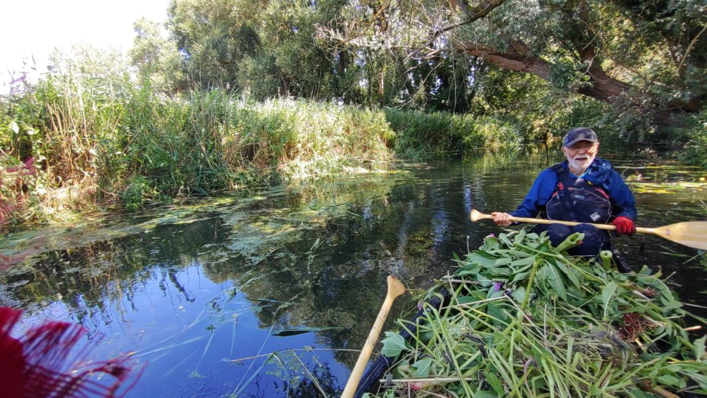
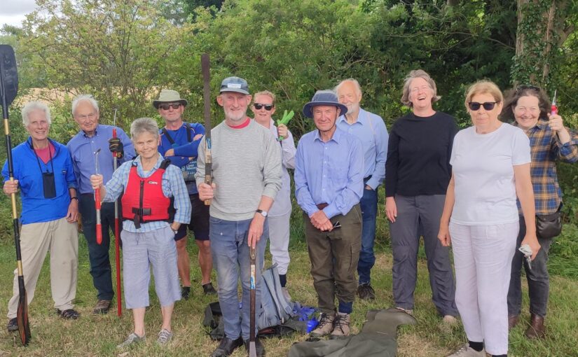
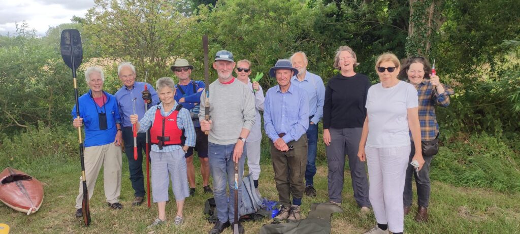
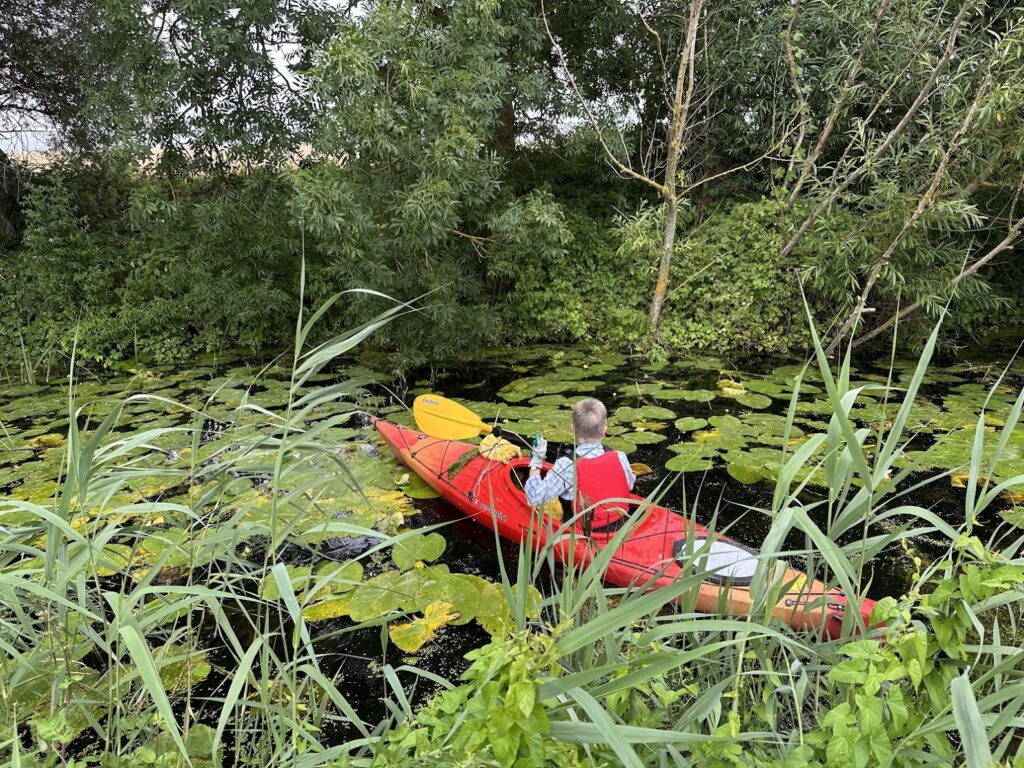
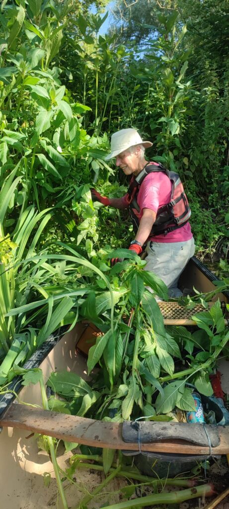
The working party on 5 July was very successful, with 12 participants, half working on foot, the others in a canoe and 3 kayaks.

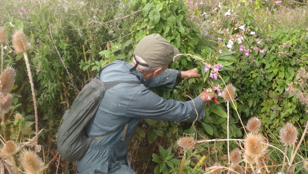
Cassie, searching for Himalayan Balsam plants beside the meadow

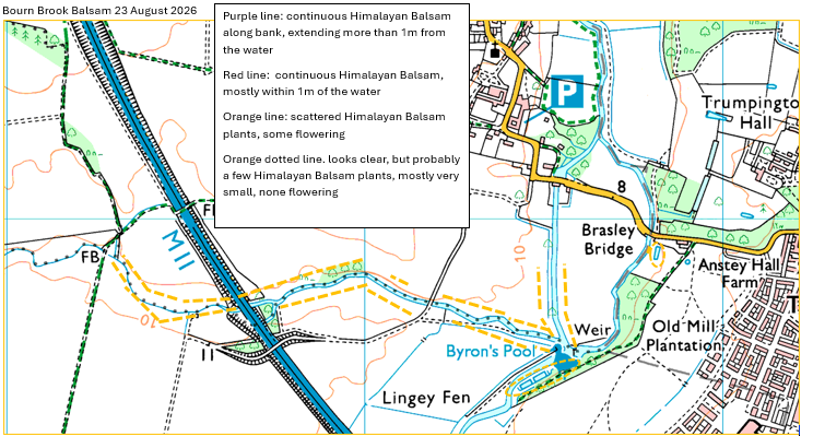
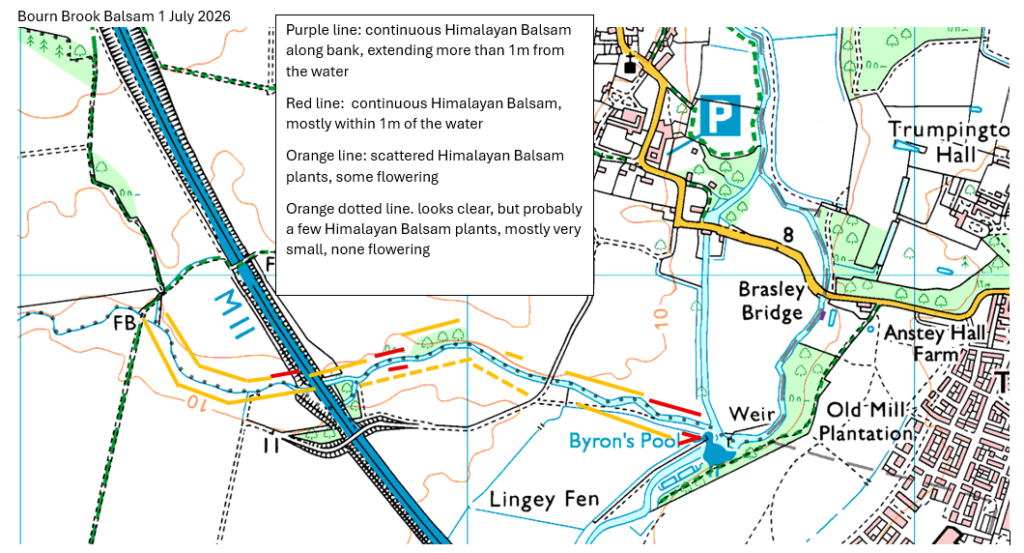
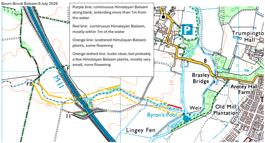
As the maps below show, this has made a major dent in the number of plants, although there is still more to do.

These maps show the approximate location and numbers of plants on 1 July, and then the situation after the working party on 5 July.

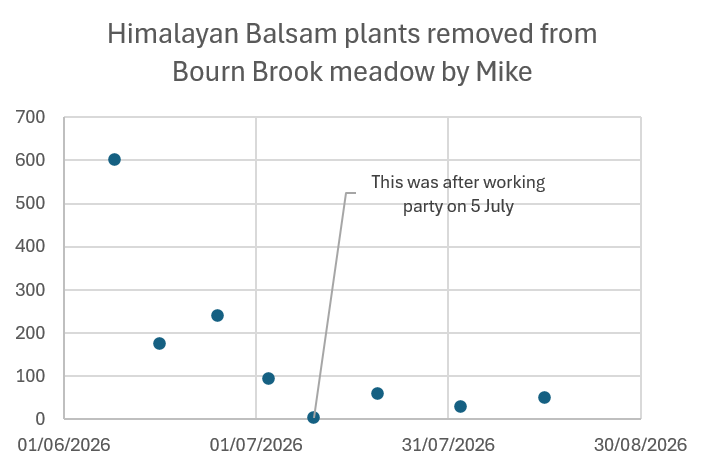
In addition to the working party on 5 July, Mike has been coming to the meadow on the south side of the brook weekly since it was mown and cut by the contractors, to remove small balsam plants as they emerge. There are now very few visible Himalayan Balsam plants.

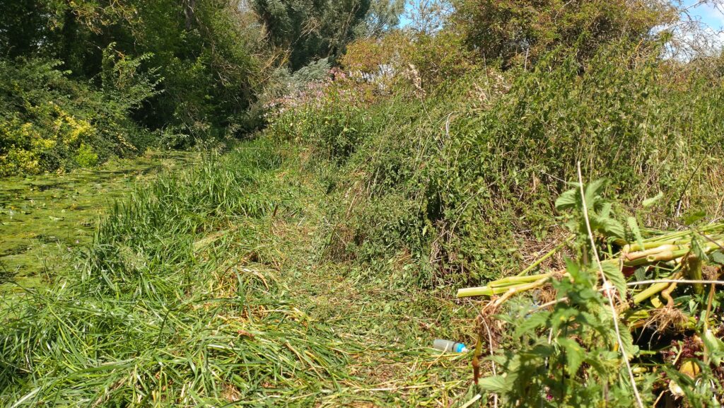
Before the working party, Richard once again had mown the margin of the meadow, to within about a meter or two of the bank. This was a huge help, removing many plants and making the rest much more visible

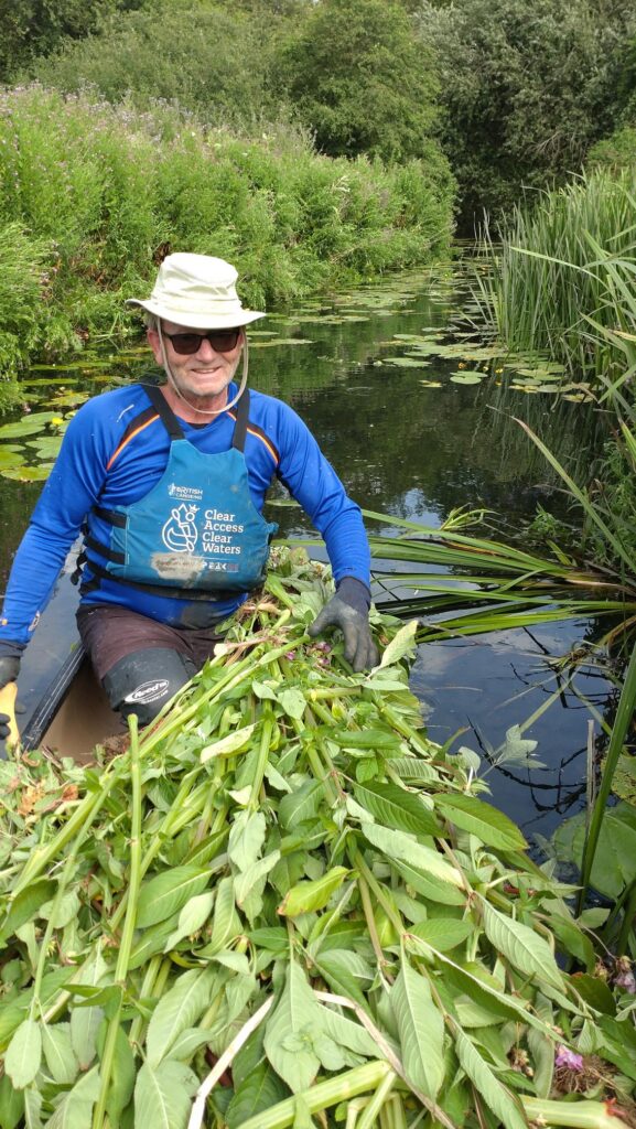
On 28 June, Tom and Anne had removed several canoe loads, mostly from between the M11 and the Cantalupe Farm bridge. They also spotted and cleared a “new” outgrowth, on the Cam about 100m upstream of Basely Bridge (Apparently this is coming from the marshy area by the Byron’s Pool car park)

On 3rd July Wim and Anne cleared a heavily infested stretch upstream of the TFC footbridge to a point about 100m upstream of the M11. [Reeds now make it hard to do much more, upstream of this point by canoe, until early next year]

There is a bit more to do (on foot) in the woodland on the north side, but its quite tangly and overgrown. Also (from the water) removing it from the reeds on the left bank, at the downstream end of the brook (shown in red on the map above), and upstream of the M11, particularly on the north side.

We’ll be organising some more working parties in July, hoping to remove as much as possible before it starts spitting out its seeds

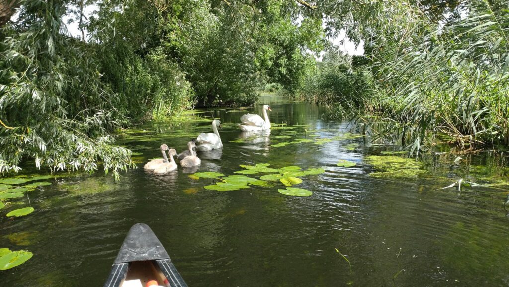
Its a lovely spot, with crystal clear water, lots of fish, swans, kingfishers (and we’re told that otters have been spotted too) so do join us and help save it from being overwhelmed by Himalayan Balsam.

If you would like to help by spending a few hours pulling Himalayan Balsam in this beautiful spot this summer, do signup here, or email us on info@camvalleyforum.uk

You can read about the “Bourn Brook Balsam” project here

Bourn Brook Balsam, part 2

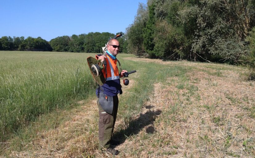
Our contractors, Gary and Reg came back on 26 May 2026 with strimmers to cut back the emerging Himalayan Balsam plants and nettles along Bourn Brook.

They did a great job, (starting at 5:45 am to beat the worst of the heat) on a blisteringly hot day when the temperatures reached 35C in the shade….

Trumpington Farm company had also helped by using their mower a few days earlier, so this minimised the amount they had to do beside the meadow on the South bank. That, in turn meant that they had time to cut back some of the balsam and nettles in the wood on the north bank too. This will make it much easier for volunteers to deal with the remaining balsam plants..

In the wood, there are a few plants that will probably need to be plucked out by hand before they re-sprout . (This is because some were cut above the first node .. If they’re cut below the first node they’ll die). However the Himalayan Balsam plants are now much easier to see, so this should be a relatively simple and pleasant task.

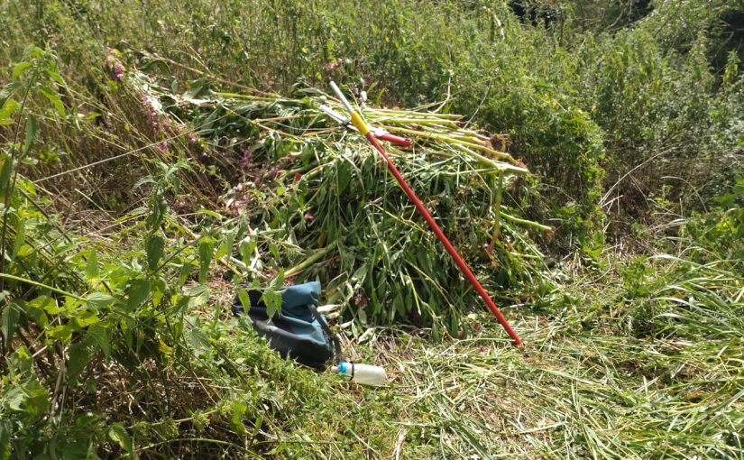
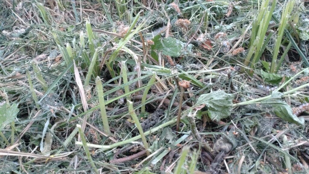
Pale green cut stems of young Himalayan Balsam plants.. these will need to be plucked out, or they will re-sprout

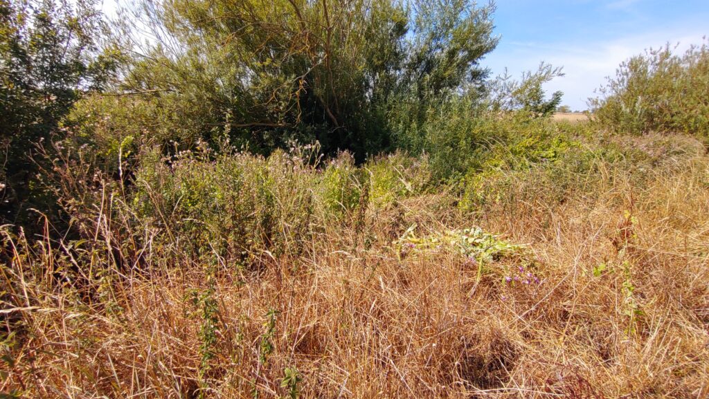
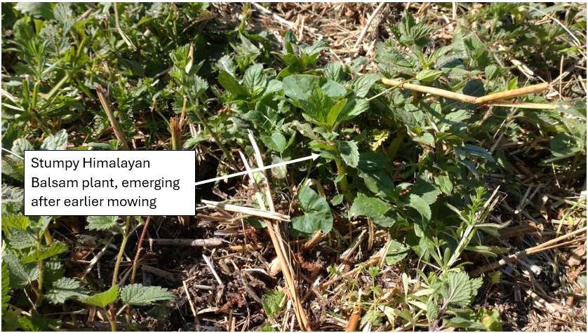
On the south bank, its worth looking out for the occasional clump of stumpy Himalayan Balsam plants, emerging after the mowing..

We’re planning the first working party on Sunday 5 July. Do let us know if you’d like to help. (Please note that this is private land, so access is only by arrangement with Trumpington Farm Company)

If you would like to help by spending a few hours pulling Himalayan Balsam in this beautiful spot this summer, do signup here, or email us on info@camvalleyforum.uk

You can read about the “Bourn Brook Balsam” project here

Press release: : The Mystery of the Murky Rhee Solved?

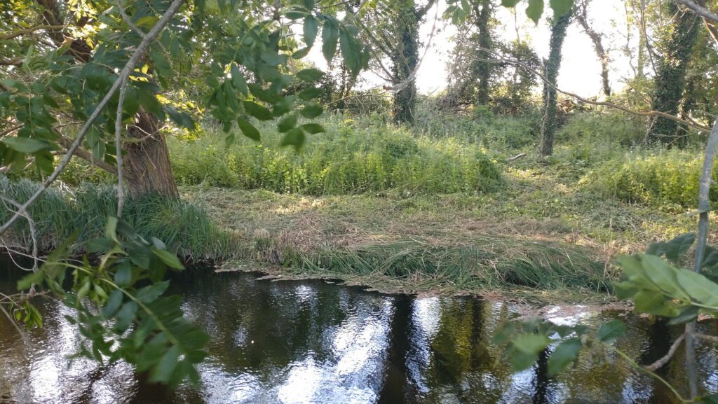
30 years ago the River Rhee at Haslingfield was crystal clear but now its murky grey.   Mike Foley and Anne Miller of Cam Valley Forum think they now know why.
Near Haslingfield 1996
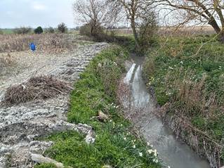
Near Haslingfield 2026

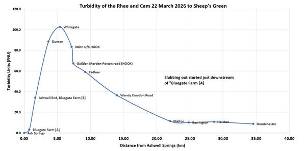
Mike has been monitoring the murkiness (known as turbidity) of the Rhee the source at Ashwell down to Clayhithe at intervals since 2022.   (The Rhee is the branch of the Cam has its source at Ashwell, flows past Haslingfield to join the Granta or “Essex  Cam” near Trumpington)  The most recent results from 22 March 2026 show, as usual, a huge peak in turbidity just a few kilometres downstream of Ashwell. The murkiness of the water then steadily improved downstream, except for a small peak around Barrington/Haslingfield, and by Clayhithe it was once again pretty clear.
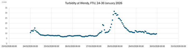
Mike says “We are confident that the peak in March 2026 in the upper Rhee is largely due to dredging that took place at Ashwell End from 28 January to about 7 February 2026. The effects are surprisingly persistent, lasting weeks or months and clearly visible far down the Rhee”

“My test result gave a peak turbidity of 100 FNU (NTU) which is shockingly poor.  Visibility was no more than around 20cm”

Mike has recently discussed the problem with the farmer who is now more understanding of the consequences further downriver.  Mike says, “However, we recognise that flood risk is a worry to farmers, and I hope that an alternative option to dredging can be found.”

Stephen Tomkins points out that “Natural Flood Management, which we want to see in the catchment is a huge component of contemporary Environment Agency thinking. The dredging should certainly stop”

In parallel with Mike’s on-the-ground investigations, Anne analysed data from the Environment Agency.

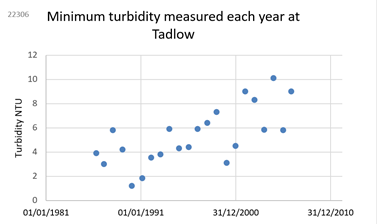
Anne says “I’ve analysed the historic data provided to us by the Environment Agency for the period 1980 – 2008. This shows that this is indeed true that the river has become more murky, particularly in the summer months. Prior to 2008, the Rhee at Haslingfield would often have appeared crystal clear, whereas today the visibility in summer is little more than 50cm.”  

“The Environment Agency’s historical data also shows that upstream, at Tadlow, it wasn’t great, but it started to deteriorate further in the mid-1990s but by 2008 visibility would still have been around 1m. (That corresponds to an NTU of about 10).

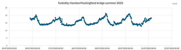
“Environment Agency has also put real time monitoring systems in the river in three places, and given open access to the data. These transmit a result once an hour, 24/7, so  I’ve been analysing the data looking for patterns.  They have been extremely useful and we hope they can stay in place a bit longer.

One can see huge peaks in turbidity after the start of upstream dredging in January and February this year.

“But there is also evidence that American Signal Crayfish are active in summer, particularly around Haslingfield and upstream at Malton.  We can see this in the data, because the turbidity is worst in summer nights, when they’re most active, burrowing and foraging in the riverbed.

One can also see their burrows in the riverbank, particularly around Haslingfield.

We wonder if the turbid state of the Rhee is due to an unfortunate combination of four factors: 

  1. Repeated dredging and slubbing-out of the upper reaches of the Rhee, aggravated by erosion of the clay riverbank, and field soils washing in from fields.
  2. American Signal Crayfish. Initially this sediment may only have had local impact, but by 2011 American Signal Crayfish were frequently observed downstream of Barrington, and since 2018 they have been spreading upstream of Barrington. We suspect that their aggressive burrowing and foraging on the bed of the river is mobilising the fine clay sediment.
  3. Modifications to Harston Mill Weir. Since March 2019, there has also been increased riverbed erosion and channel incision between Barrington and Harston, due to the modifications to Harston Mill Weir in March 2019.
  4. The Local Geology. The upper Rhee, near its source at Ashwell, and in tributaries such as the Mill River have fine clay soils, and because of dredging and erosion the gault clay has now also become exposed in the riverbed much nearer to Cambridge, for example from Barrington to Harston.

Although it is impossible to change the local geology,  this suggests three aspects to the solution.

  • Encourage the upstream famers to stop their dredging activities, and to protect field ditches from silting up.
  • Help stabilise the banks by ceasing herbicide use and reducing the shading (that has developed over the years) so vegetation can regrow and bind the soft banks.
  • Repair the damage caused by dredging. We understand that the best solution is to add gravel or aggregate, which then reduces further erosion of the stream bed.

These measures should produce a significant improvement in water quality by reducing turbidity.

As EastWestRail are planning to dig a tunnel near Haslingfield and build a bridge over the Rhee near Harston, we hope they can make a significant contribution to the cost of this work.

For further information, read the full report “The Mystery of the Murky Rhee” here https://camvalleyforum.uk/publications/

Bourn Brook Balsam Project

For some years, we’ve been trying to eradicate the Himalayan Balsam on the lower reaches of Bourn Brook. Although a pretty plant, it is highly invasive, so crowds out everything else. However, our problem has been that reeds and nettles have made it very hard to remove the Himalayan Balsam from the lower reaches of Bourn Brook, so its been quietly spreading… But we’ve now got help!

Pembrokeshire have a very useful advice leaflet, which includes the suggestion of using contractors to brush cut an area in early summer. They point out that this very substantially reduces the amount that needs to be hand pulled by volunteers, and “on a flood free site can get rid of most plants within a season”.

We’re excited about this idea, so we raised the funds to engage contractors to help us by cutting back the reeds and nettles in advance of the main volunteer working parties.

We’d realised that we needed to start by cutting back the reeds, before the reed warblers arrive in mid April. The plan is that this will encourage them to make their nests a few hundred yards downstream, where they won’t be disturbed while we deal with the Balsam. They can then return next year (or the year after)

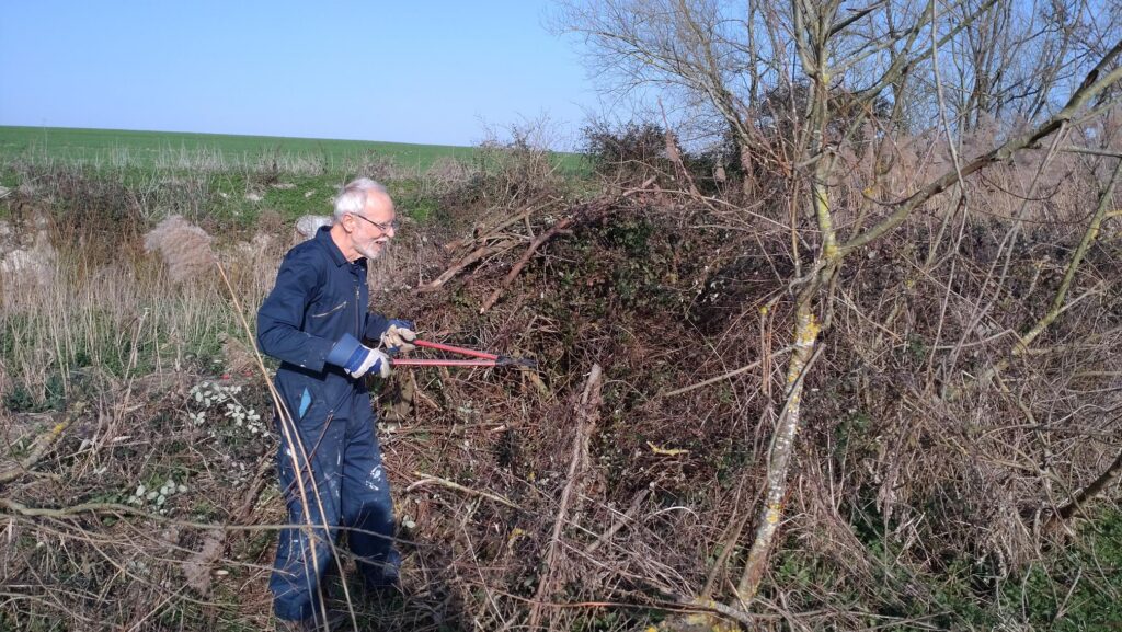
We started with a little preparation work in March 2026, when volunteers cut back a bramble bush and piled up some fallen branches.

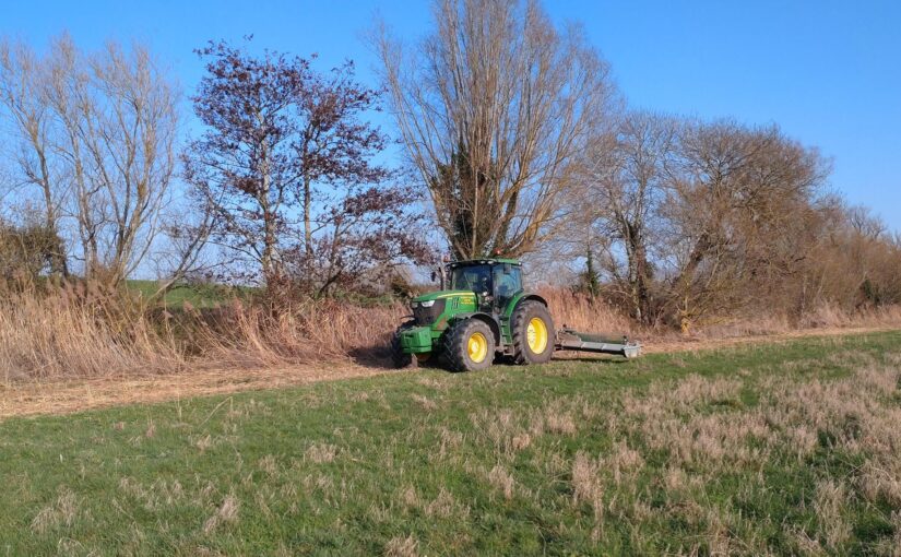
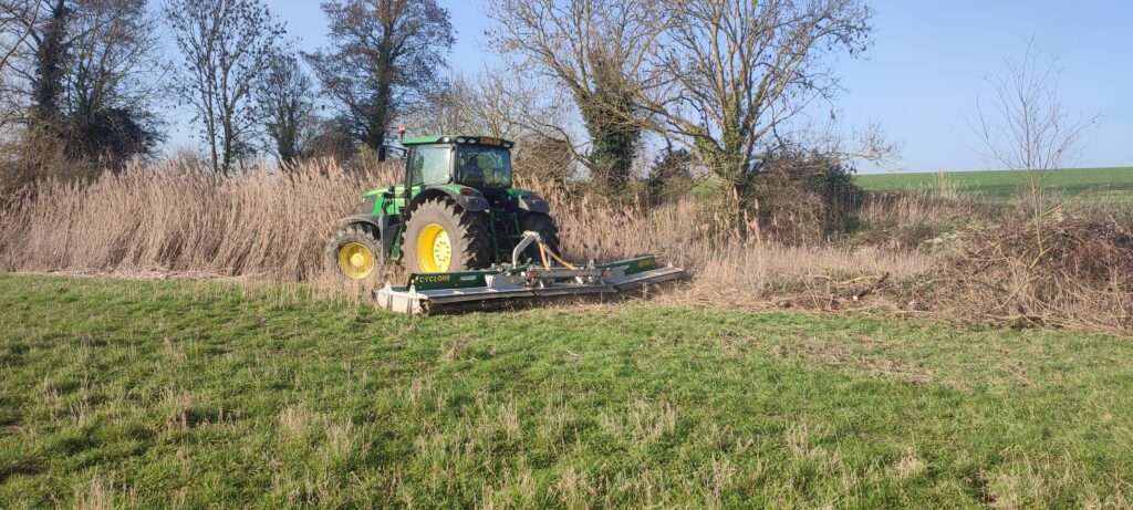
Trumpington Farm Company then kindly used their flail mower to cut what they could.

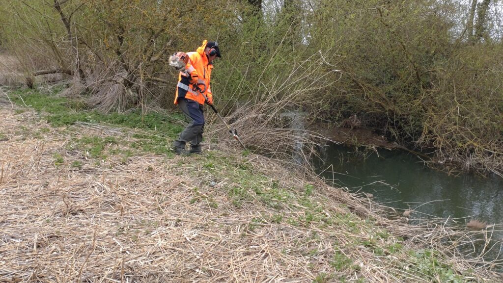
Then on March 24th 2026, our contractor (Gary, from MLP) worked hard for 2 days cutting back the more fiddly bits along the banks of the brook.

This created a delightfully clear meadow, all the way to the bank of the brook

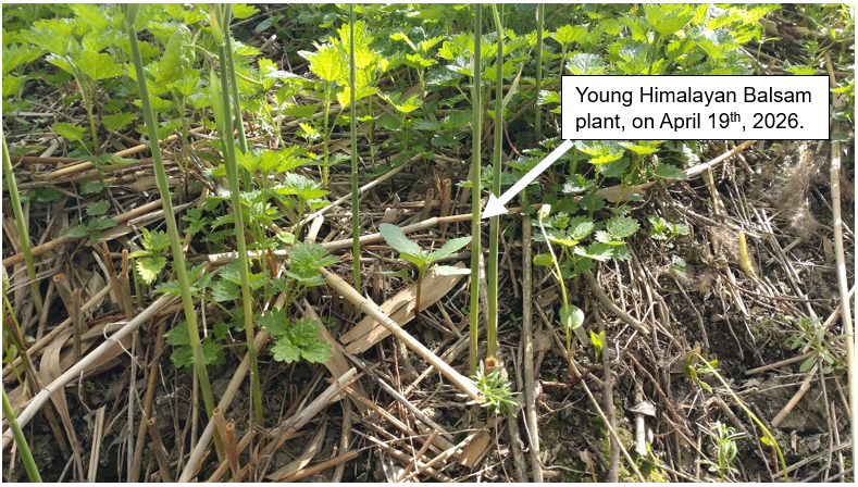
By mid April we could see tiny Balsam plants plants starting to emerge, ahead of the nettles. It was very satisfying pulling them out by the handful!…

We repeated the cut on May 26th, aiming to once again, remove all the nettles, reeds and Himalayan Balsam plants on the south bank of the brook. This will substantially reduce the amount that we need to do by hand. It will also make it much easier to see new Himalayan Balsam plants when they start to emerge from remaining seeds.

To “finish” the job, we plan to run volunteer working parties roughly monthly from June – October to pull up any newly emerging Himalayan Balsam plants…. With your help and persistence, this should go a long way towards eradicating Himalayan Balsam from this beautiful spot, just upstream of Cambridge.

The first working party is on Sunday 5 July. Do register here

If you would like to help by spending a few hours pulling Himalayan Balsam in this beautiful spot this summer, do signup here, or email us on info@camvalleyforum.uk

Haslingfield Sewage Works “gusher”

In February 2026, we were concerned to see a mysterious 4” hole gushing water under the eastern boundary fence from Haslingfield Sewage Works. This flowed into a ditch, then into the Rhee.

Despite the dry weather, the gusher was still flowing 10 days later. We were also concerned that the EDM storm overflow monitoring had gone offline on 24 February, having been previously showing an active storm overflow from 3 Feb- 23 Feb. Could these two things have been connected?

On 2 March 2026 we reported it to the Environment Agency and Anglian Water. We have also been investigating ourselves…

Our immediate concern was that it could be a leak from the Sewage works’ tanks, so we tested the “gusher” for E.coli. This showed that it had an E.coli of 4,500 /100ml. Although this is unhealthy, it was much less contaminated than the treated effluent from STW which had 29,000 E.coli/100ml. For comparison, Bathing water will be classified as “Poor” if the E.coli is occassionally > 900/100ml

When we reported it to Anglian Water they responded very quickly and bunged up the pipe. They tell us that it can’t be sewage, because the iron levels in the gusher were very low (0.05mg/l) and they dose all the incoming sewage with iron to remove phosphates. They said they suspect its surface water or a land drain. This seemed a bit improbable to us, but still….one has to keep an open mind….

The Environment Agency visited Haslingfield Sewage Works on 10 March, and reported back to us a few days later, saying:

“Our Officers attended site on 10 March and we identified that that the EDM monitor (records when the storm tanks are spilling to the environment) was situated in a channel with standing water (storm sewage) which means that the probe continued to be in contact with the water even when no discharge was taking place from the storm tanks. This resulted in false activations of the EDM monitor and was recording false ‘spills’ to the environment. The monitor has been taken offline for this reason, and AWS are scoping solutions to allow them to accurately record spills from the storm tanks

We also observed the small pipe as shown in the photographs attached to your email. The pipe comes directly from the boundary of the STW. This pipe has the appearance of a land drain. AWS Ltd bunged off the pipe, which led to water backing up on their site within cabling ducts and manholes. To alleviate this problem AWS are currently pumping the liquid that is backing up in the onsite manholes through the sewage works. AWS have tested this water, and it contains very low ammonia. It is possible that there could be a leak of final treated effluent wash water (used to wash screens etc.) that has made its way into the drain, or the water could be run off from farmland from beyond the site. AWS are going to conduct a drainage survey to try and determine where the liquid is coming from.

A Compliance Assessment Report (CAR) will be sent out and this be available on public register 28 days afterwards. CAR forms can be viewed using Environmental Permitting Regulations – Discharges to Water and Groundwater.”

We went back to check progress on 22 March and 1 April. The orange bung was still in place, but a few meters to the left, another old pipe was now furiously dripping water. There was no visible surface water around, (and we could see through the fence that the storm tanks were empty) so where’s this water coming from? Is it a leak of Anglian Water’s “wash water” or could it somehow be ground water, despite the dry weather?

Looking around the site we spotted that there was a field drain emerging from the field just at the north east corner of the Sewage works.

Despite the dry weather this was flowing vigorously..

It seemed bizarre that so much water was coming out of an apparently dry field, so what was going on? Could it possibly be that springs have formed there? Or is it just that the fields still haven’t dried out at the depth of the field drain?

We’ve been told that since the nearby Cemex cement works at Barrington closed in 2008, and stopped abstracting water from the aquifer, various new springs have started forming in the area.

I did a bit of digging into historic maps available from the National Library of Scotland and Wow… The 1956 map marks a Spring, exactly at the site of the sewage works that was built a few years later

1:25,000 1956 OS map
1:10,000 1960 OS map

Today, this seems a really dumb place to have chosen for a sewage works, but in the late 1950s, could it have been deliberately sited there so the spring water would help wash out the treated sewage?

And today, is a re-emerging spring responsible for the water that’s now accumulating in Anglian Water’s cable ducts and manholes, escaping off-site through long-abandoned field drains? And could a re-emergent spring line be causing the subsidence in Anglian Water’s channel that were told about in 2021, so that the EDM sensors are once again sitting in a puddle, giving the false impression that there’s a storm overflow in progress?

Whoever it was that chose the site, this is now a problem for Anglian Water to fix..

AGM and Annual Lecture 2026

The formal AGM was followed by a brief review of the last 25 years, a celebration cake, and the annual lecture by Alison Matthews, Chalk Stream Programme manager at The Rivers Trust. You can see some photos, and download the presentions below

The minutes of the formal AGM are available here [to be added]

Anne then showed 10 slides in 200 seconds, illustrating some key activities and achievements over the last 25 years. You can download the slides here

This was followed by Cllr Katie Thornburrow saying a few words about how important Cam Valley Forum’s work has been and ceremonially cutting a celebration cake.

The cake (a vegan carrot cake) was made for us by Arjuna Wholefoods and funded by the committee: it was both delicious and a work of art!

After the break, Alison Matthews, Chalk Stream Programme Manager at The Rivers Trust, gave a fascinating presentation on Finding a way to protect and restore our Chalk Streams

You can download her presentation here