Why are the Rhee and Cam so murky?

Introduction

On 2 December 2025 Mike Foley of Cam Valley Forum’s (CVF) Mike Foley presented a talk on river turbidity and its most probable causes at Newnham Croft Social and Sports Club, to an audience with a wide range of interests.  

The slides are available here. They have been edited to provide a little more of the details presented verbally at the talk, and this Blog accompanies the slides from the talk. (It is illustrated with a few of the slides, but we recommend you look at the full set of slides too)

This talk is an update on the reports on turbidity published 31 Dec 2022 and 31 March 2025.

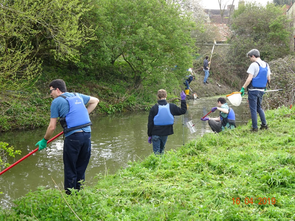
The investigations into turbidity were separate from CVF’s monitoring along the Cam and Rhee of faecal indicator bacteria from 2021 which focused on trying to locate the main sources of the organisms. We now know these enter the river continually in fairly high numbers in the discharged, treated effluent at Haslingfield sewage treatment works, and from other locations.

If you have no time to read further, Mike’s conclusion is that soil in suspension is the most probably reason for the turbidity, and downstream of Wendy into Cambridge, turbidity is further exacerbated by the presence and activities of the non-native, invasive American Signal Crayfish, now present in large numbers.  The clayey nature of the soil type along the Rhee is one important factor in this river being far more turbid than others in the Cam Catchment.   We suspected this all along, but for reasons that will unfold, we thought it was necessary to investigate if other causes very unlikely.

The history

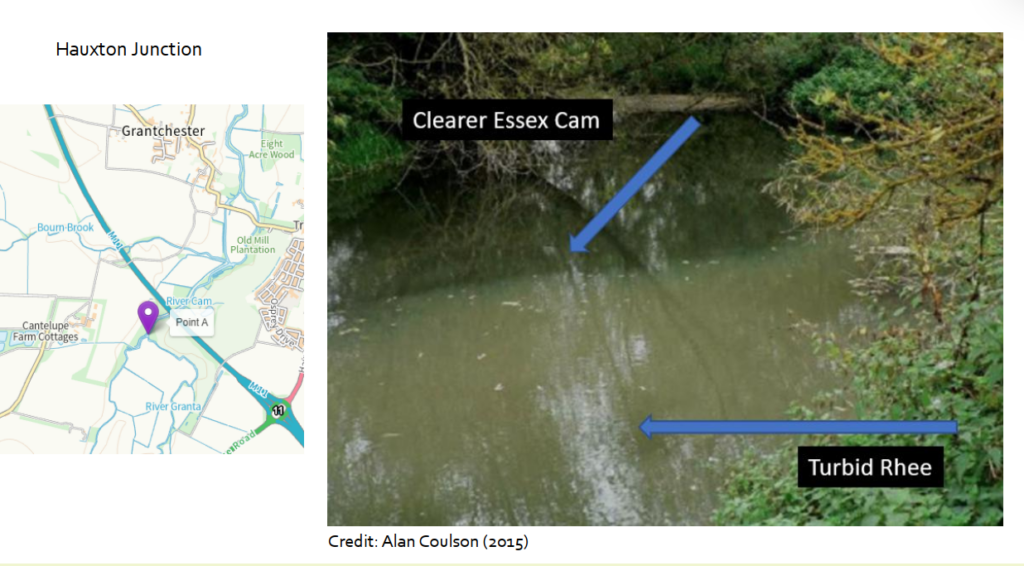
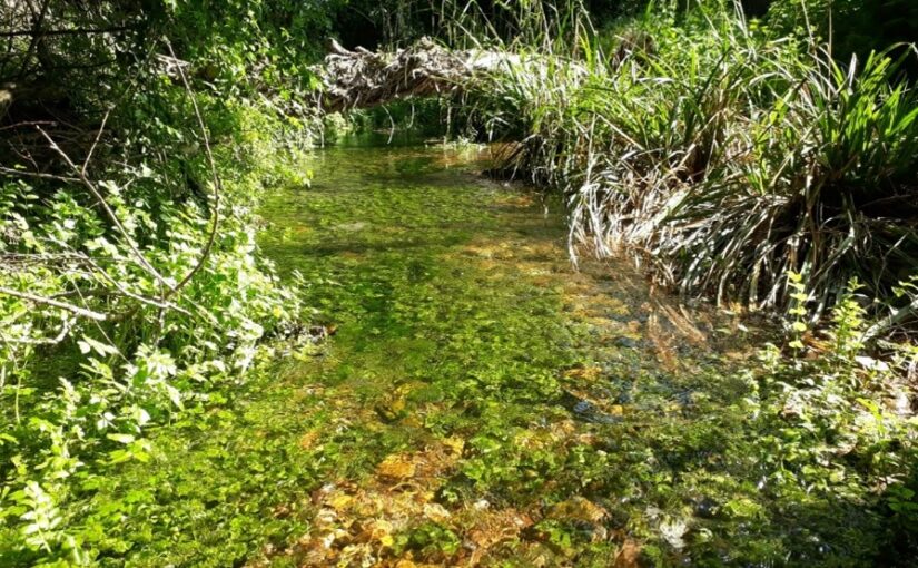
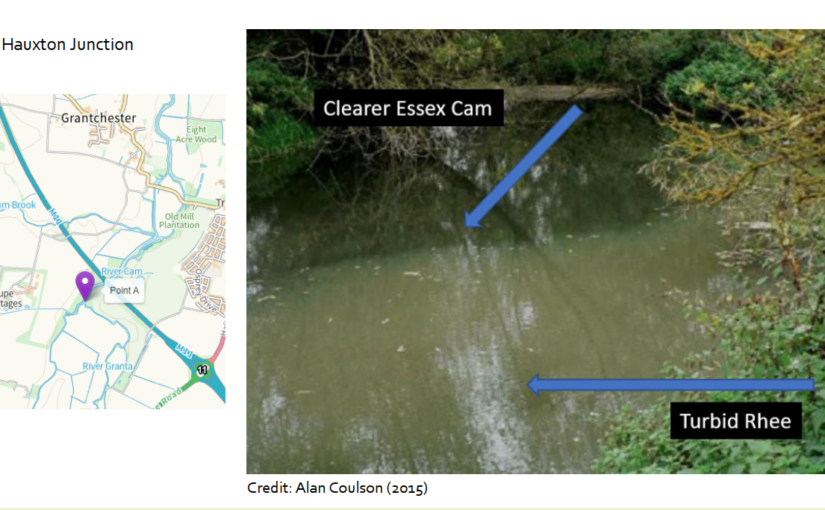
Turbidity is the formal name for murkiness or cloudiness of water.  A former CVF committee member and angler Alan Coulson noted in 2015 that something wasn’t right with the Cam.  He photographed the Cam at Hauxton Junction where it joins with the Rhee.  The Rhee was very murky whereas the Cam seemed clear. 

In early 2022 while Mike was sampling for faecal bacteria and nutrient levels, he realised that lowering the shiny rake vertically into the water was a simple way to measure “depth to invisibility” (DTI).  In other words, he could measure how far down he needed to lower the rake until the head became just invisible.  He enthusiastically built up a dataset of DTI from various sites over the year and into 2023.   When there were sufficient readings from the Byron’s Pool part of the Cam (actually Brasley Bridge) he sorted the results according to low flow and higher flow conditions.   Spookily, at low flows, i.e. high-summer flows, turbidity increased as flow decreased.  This did not suggest a specific cause but was a good point to start considering options.

Soon, Mike was using a Secchi tube, extended to 165cm length to capture low turbidity events.  He also occasionally used the nephelometer Hanna HI-93703 and the Hanna Multiprobe HI-98594, loaned from Hobson’s Conduit Trust, with thanks to Dr Steve Boreham for maintaining their calibrations.

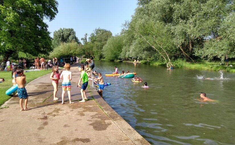
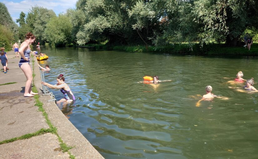
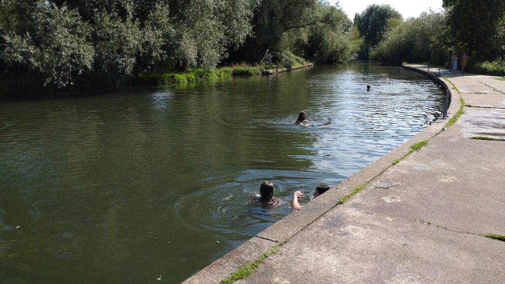
How turbid are the Rhee and Cam?

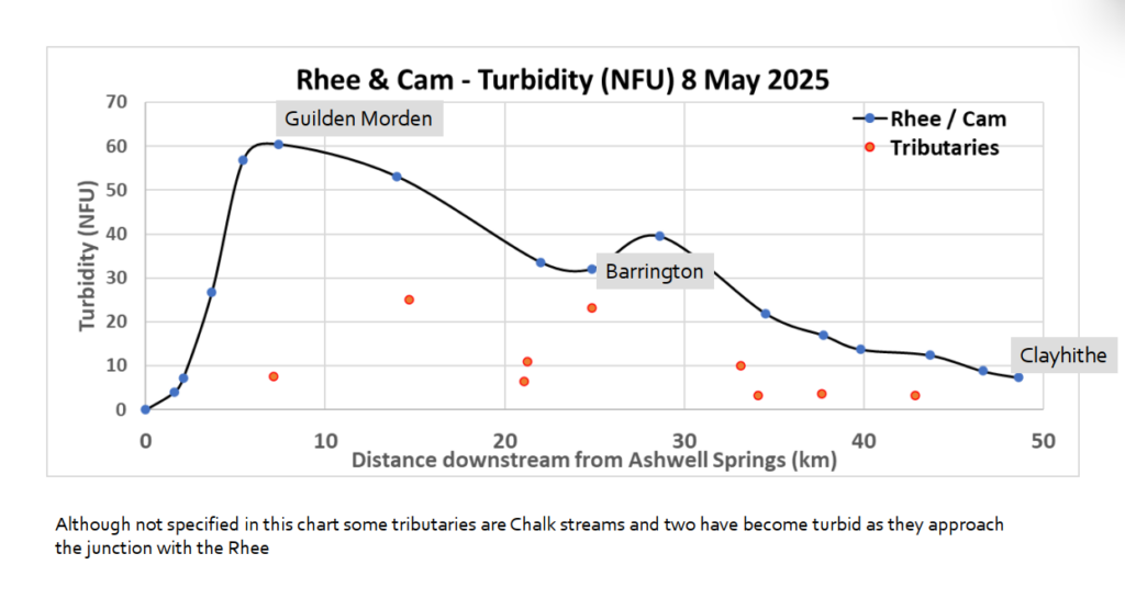
Several monitoring excursions in 2025 have clearly shown that turbidity can reach very high levels in the upper Rhee, peaking around Whitegates Bridge/ Potton to Guilden Morden road/Tadlow (94 FNU at Tadlow on 20 May 2025). One the same day, Byron’s Pool’s reading was 25 FNU, but still obviously turbid.  Turbidity in summer can be high at further sites down to the Haslingfield-Harston road bridge, slightly lower at Byron’s Pool, lower still at Sheep’s Green and very low at Clayhithe.

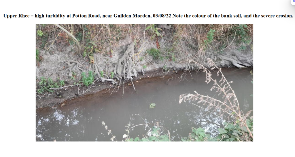
Local farmers around Tadlow recall the Rhee was clear only a few years ago.

Phosphate / sewage pollution

In 2022, WASP (Windrush against Sewage Pollution) reported,  “One common feature of the rivers suffering turbidity issues is sewage pollution and a potential link with high phosphate inputs from STWs.”  Could these be a major cause of our turbidity?  The answer seems to be no. 

For instance, the highest turbidity in 2025 was measured along the Rhee near Tadlow where CVF sampling showed that stretch had the lowest phosphate (<0.084 mg/l) of the entire river. Furthermore, CVF monitoring of the Rhee and Cam for phosphate in 2021/2022 from Harston showed no decrease in concentration at the lowest part of the Cam we monitored – Clayhithe (mean of three samples, 0.442 mg/l orthophosphate-P).  Yet Clayhithe had the clearest water of the entire Cam.

There exists a particulate whitish chemical called “Struvite” which contains phosphate.  This forms when there are equi-molar amounts of ammonium, magnesium and phosphate present – MgNH4PO4.6H20 – and it can form at sewage works.   Routinely Mike sampled effluent at several works and using either a Secchi tube or nephelometer, and if struvite was present in sufficient amounts it would show up.  One sampling at Haslingfield STW on 30 April 2025 coincided with a storm overflow, and resulted in the following turbidity readings (FNU):  (a) treatment using filtration beds, 5.15.  (b) treatment using the activated sludge tank, 1.07.  (3) pure storm overflow from storm tanks, 7.45.  These readings show that the effluent turbidity so far too low to be a contributor, on that occasion.  Furthermore, Mike has compiled readings that show effluent at other works can be remarkably clear, though there is usually some small amounts of natural brown particulate matter present, called “floc”, that is part of the treatment process.  For instance, Melbourn and Linton STW effluent can be so clear that after filling the entire 165cm long Secchi tube with effluent the Secchi disk at the base of the tube is still visible.  

Thus, treated sewage (also the storm overflow above) at the numerous Anglian Water sewage works discharging into the Rhee, Cam or tributaries appear not to contain sufficient particulates to contribute to high river turbidity.    

Nor do measurements of the effluent reveal levels of bacteria high enough to cause a turbid  “soup”.   Also, it’s not in the nature of naturally occurring aquatic true bacteria in a flowing river to form soups sufficiently turbid to explain what we have been seeing.  

Algal blooms

Cyanobacteria (blue-green algae) can create turbidity – this has occurred recently at Todd’s Pit at Milton Country Park – but high power microscopical examination of Rhee water show no cyanobacteria in large numbers.

In recognition that the Cam sometimes appears green, a Turner Aquafluor detector of green algal Chlorophyll a was loaned in 2024 from the Zoology Department, Cambridge University.  Samples from sites on the Rhee and Cam where the water was grey-brown were found to have zero amounts of Chlor a. No river samples were green.

Suspended soil

Soil appears to be the culprit.  It cannot be coincidental that the colour of the arable soils in the upper Rhee  and the Rhee banks have some greyish hue in them that matches the colour of the river water in the summer.  Mike has passed on samples to Dr Steve Boreham of WildReach.co.uk who confirms that they contain soil.  However, it is not all soil – there is also some organic matter and particulate calcium carbonate.

It seems that only small amounts of soil are needed to create turbid conditions.  It could be soil resuspended from the river bed, etched out of the bank, or newly arrived via arable ditchworks or directly from fields into the river.   The puzzle still to solve is how turbidity in the upper Rhee persists during periods of dry conditions when ditches are dry and there is no runoff from fields. 

It seems reasonable to ponder that suspension of extremely fine clay into the water at one point will not persist too far downstream.  Perhaps it is only 50m, depending of soil particle size. But if uplift is happening at one point, it will also be happening a little further downstream, but from this second point the soil will be carried a little further on. 

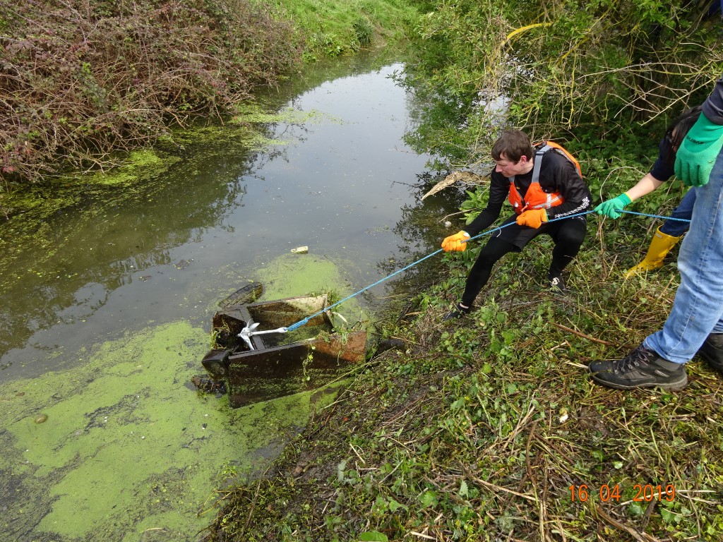
A controversial issue is the dredging of the Rhee to reduce the risk of overtopping during high winter rainfall.  Dredging may expose fresh layers of clay that can lift more easily into the water.

American Signal Crayfish

In 2023, Mike saw persistent high turbidity in the Cam during the summer when for weeks there was no appreciable rainfall to drive soil from ditches or arable fields into the river.  The tributary Bourn Brook was actually fairly clear compared to the Cam and thus not a major contributor.  Some Chalk streams were slightly turbid but not enough to increase turbidity of the Rhee and Cam.  In fact, they would be diluting the turbidity

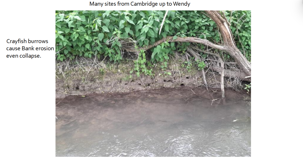
The simple answer to turbidity in dry spells seems to be American Signal Crayfish.  This invasive crayfish has been shown markedly to increase turbidity.  Populations can be large: over 1600 crayfish of all sizes and age were taken out of a Yorkshire beck headwater just from a 10m stretch.  Largely active nocturnally they stir up bed sediment while fighting and feeding, and when capturing and eating juveniles, and tunnel into the bank up to 200cm depth (mostly up to 60cm on the fish pass at Byron’s Pool).  The excavations must allow continuous suspension of soil, whilst mature tunnels cause erosion, sometime causing bank collapse.

The Environmental Agency has concluded that that the turbidity of both the Windrush and parts of the Rhee involves the presence of American Signal Crayfish.

Mike has noted increasing turbidity in the Granta and the Essex Cam /Granta at Hauxton Mill. Crayfish are populating more stretches of our rivers (and are common at Hauxton Mill) and as tagging has shown that they can march 100m upstream overnight, he foresees invasion forces moving steadily towards the headwaters.  Numbers may be very low at the front of the invasion – however, it has been proposed that only one female and one male need to be present in stretch of 200m if the stream is 5m wide to be the Minimum Viable Population Density, usually undetectable.  Over future years we will see more colonisation, and probably therefore even higher turbidity levels where the geological base of the soil in that stretch is of the right type to be suspended.

Conclusions

  • No evidence that the prolonged turbidity is caused by algal blooms
  • Not obviously sewage works related
  • Not a direct phosphate effect
  • Upper Rhee – probably soil alone
  • Lower Rhee and Cam – soil + American Signal Crayfish
  • The geological soil type seems pivotal in determining how turbid the water becomes from soil suspension.
  • Local farmer perceptions reveal the upper Rhee was not nearly so turbid just a few years ago

Actions

  • Reduce soil runoff from arable fields into ditches or direct into the rivers
  • Discontinue any dredging of the rivers (when possible)
  • Reinforce bank sides
  • Need for scientists to devise a control measure for the crayfish
  • Trapping of crayfish to reduce populations needs to be thorough and not just removal of adults.  A near-impossible task on large stretches of the Rhee and Cam.
  • Testing of the upper Rhee with environmental-DNA specific to American Signal Crayfish to determine how much of the Rhee around Tadlow it has colonised.

A Collaborative Restoration Plan for the Cam

Comment from Cam Valley Forum on the announcement of the government funding (£179,602.54 from the Water Restoration Fund) for the project “A Collaborative Restoration Plan for the Cam”

Cam Valley Forum welcomes any funding for work to improve the health of the Cam and its tributaries, and congratulates the Wildlife Trust BCN on being awarded these funds.  This project is one of 51 across England that have been awarded grants by the Water Restoration Fund (WRF). 

The Collaborative Restoration Plan for the Cam consists of three main elements.

  • A Catchment officer for the the Cam Catchment Partnership to create a catchment plan
  • Catchment Habitat Opportunity Mapping
  • A Sediment Study, covering the whole of the Cam, Rhee and Granta

All three elements are led by the Wildlife Trust BCN (although parts of the project are being delivered by other partners, who are getting paid by the Water Restoration Fund via Wildlife Trust). Cam Valley Forum is a founder member of the Cam Catchment Partnership. 

The Water Restoration Fundmoney has permitted the appointment of a short-term catchment officer for the Cam Catchment Partnership, who is creating a catchment plan to be published in spring 2026.  It also includes two catchment-wide projects, namely Catchment Habitat Opportunity Mapping and a Sediment Study.  The mapping will be useful in discussions with landowners and will tie in with the Local Nature Recovery Strategy.  The Sediment Study will help us understand where sediment is coming into rivers and how it moves within the catchment, so we can find the best ways to address the excessive amounts of sediment in our rivers.  There are also some smaller projects, all of which support the catchment partnership’s aim to empower local people and to ensure that local knowledge informs water resource and river restoration strategy.

About the Water Restoration Fund

However, our rivers need more.  Cam Valley Forum, with the Wildlife Trust, has concerns about the governments approach to the Water Restoration Fund.  It has been created from the fines imposed on the water companies for the pollution they have caused.  Ideally, the water companies should be preventing such pollution occurring in the first place but, if it does happen, they should indeed be paying for the clean-up.  In the period 2020 – 2025, these fines amounted to some £850m – a shocking figure in itself.  But the £10M being made available in this current round of the Water Restoration Fund is a tiny proportion of that. The grant for the river Cam is helpful, but insufficient to ensure that the activities initiated can remain sustainable.  A larger pot (possibly £100M) is promised in the next round of the Water Restoration Fund.  However, Cam Valley Forum feels that the government is showing an insufficient sense of urgency to the problems facing our rivers and chalk streams.

FAQs about Bathing Water Designation at Sheep’s Green

How does designation help clean up the river?

Designation is a powerful tool to accelerate the cleanup of the river. Firstly, because it shines an official spotlight on the water quality. Secondly, because the water quality here will almost certainly be rated as “poor” it imposes Statutory Obligations on industry to reduce the pollution from sewage works, urban sewage overflows and agricultural slurry.  Unlike general non-statutory calls to reduce pollution, the water industry responds to these Statutory Obligations, so this prioritises and drives real change.   Some of the key pieces of legislation are the ‘Bathing Water Regulations 2013’ , WINEP, which governs the water industry funding and WISER (Water Industry Strategic Environmental Requirements) As explained here, following designation, Ofwat are likely to require the work to be completed by 2027. Without the statutory “Driver” of Bathing Water Designation, Anglian Water could take as long as they liked, so the improvements would be likely to take much longer…. maybe decades.

Designation helps accelerate the cleanup, but we’ll need to keep up the pressure for wider change too. Ultimately, we need to change our relationship with the natural world, so water can be good quality everywhere. However, this will probably take decades and the whole farming and water management system will need to change.

I’ve heard that areas with Designated Bathing Water status MUST promote bathing in the area, which will increase the number of visitor. Is this true

No. This is completely false

The rumour probably results from the line in the Bathing Water Regulations 2013

3.—(1) Part 1 of Schedule 2 lists the surface waters that have been identified in England, other than excluded pools and waters, at which the Secretary of State expects a large number of people to bathe, having regard in particular to past trends and any infrastructure or facilities provided, or other measures taken, to promote bathing at those waters.”

We are informed that this means that it is a site that existing bathers use, with no signage prohibiting swimming, and where there are pre-existing facilities or infrastructure, such as steps, that support bathing.

We’ve also had confirmation from Clean River Ilkley that designation is not about marketing, and does not increase the number of visitors

Will designation increase the numbers of people coming to Sheep’s Green and the nearby Paradise Local Nature Reserve? 

In the short term, no. We are counting “bathers” this summer, and we qualify for designation. (Defra require an average of over 100/ day on the 2 busiest days, and we counted 237 on 10 August and 184 on 19 August and 478 on 10 September)

We know the water quality on the Cam is very likely to be rated as “poor” which will require the council to put up a sign saying “Bathing is not advised”. This will deter rather than encourage swimmers. The experience of other river groups, such as at Ilkley in Yorkshire, is that designation has made no difference to numbers.

However, 3-5 years time, hopefully the water quality downstream from Haslingfield Sewage Works will have improved (something we’ve all been campaigning for).  More people are then likely to feel safe enough to swim in the Cam at Byron’s Pool, Grantchester Meadows and Sheep’s Green.  

We welcome more people connecting with nature, particularly in our highly unequal city.

When considering the Sheep’s Green area, it’s important to remember that the vast majority of the people that come to the area, do so to access the Lammas Land paddling pool, playground, cafe and local walks. When we counted visitors to Lammas Land and Sheeps Green on 19 August 3:40pm-3:55pm, only 2% were swimming in the river. This means that even if the number of wild swimmers at Sheep’s Green does ultimately increase, it will make very little difference to the overall numbers in the area.

Why choose Sheep’s Green, when most people swim at Grantchester Meadows?

Defra only allow applications from inland sites if there are toilets within 500m, and if it’s a short stretch of less than 500m.  This ruled out applying for Grantchester Meadows.  Nevertheless, designation will benefit the whole river between Haslingfield and Cambridge, and people will remain free to swim anywhere.

I’ve heard the council wants it to become a “Destination”. Won’t this increase numbers?

This rumour is based on a misunderstanding. It may have come from the section of the city council motion on 20 July that ‘affirms the goal …of having the water management plan for our chalk streams based on being an ‘environmental destination’ with subsequent protection as sites of Special Scientific Interest (SSSI)”. 

Note that in water resource management government jargon, an “environmental destination” means a “long term goal”, not a “destination” in the tourism sense of the word.  The council motion is about getting a higher level of protection for the chalk streams from abstraction, which is something we very much welcome.

Cllr Katie Thornburrow has confirmed that the City Council has NO plans to turn Sheep’s Green into a vistor destination, and none have been discussed

I’ve heard the council will have to build showers and changing rooms and dredge the river. Is this true?

No. Bathing Water Designation is for the benefit of current “bathers”.  Theres no requirement to improve facilities, or to carry out any other changes.

Cllr Katie Thornburrow has confirmed that the designation does not require new facilities to be built and the council has no plans to do so

I’ve heard people calling it a Designated Bathing Area or DBA, saying that this means it’s obvious its intended to attract people to a small designated area. Is this correct?

No. The correct name, used by Government is “Designated Bathing Water.” This is because bathing is NOT restricted to a small area. In a river, water flows though the site, so a large stretch of river benefits from clean-up as a result of designation .

Are you independent?

Cam Valley Forum is a voluntary group, established in 2001, registered with HMRC as charitable. We are entirely independent, and politically neutral. 

As our website states, “We work with our extensive network of partners to protect and improve the environment of the River Cam and its tributaries”  We frequently criticise the water companies and others for pollution and over-abstraction.

In 2021, when our volunteers started monitoring the Cam for faecal bacteria (ie bacteria from poo), we received a small grant of £1,500 from Anglian Water as a contribution towards the costs of laboratory analysis. In September 2022, Anglian Water took over the test program, and they are providing us with test results until September 2023.  We are publishing these on our website here

We think the public deserve to have more reliable, independent information on water quality, than that provided by volunteer citizen scientists like us, or by the Water Company itself. This is why we welcome the help of a very experienced and professional body like the Environment Agency, who have responsibility for monitoring Designated Bathing Water sites.

Will it be 100% safe? 

Bathing Water Designation will reduce the chance of diarrhoea and vomiting from ingesting faecal bacteria. 

Most people who swim in the Cam do so without problems, however wild swimming is never 100% safe, so you should make your own judgement (and keep your mouth shut while swimming).  For certainty about safety, we advise swimming in swimming pools like Kelsey Kerridge, Abbey and Jesus Green Lido where the water is filtered and chlorinated, and the pool is supervised by lifeguards.

If the site becomes a Designated Bathing Water site, the City Council will have to display the Environment Agency’s annual water quality rating, in order to help inform the public of the level of risk. In addition to this, we are also encouraging the Council to display some Wild Swimming safety advice, as Oxford City Council has done at their Designated Bathing Site.

237 bathers at Sheep’s Green

On Thursday 10th August, the Cam Valley Forum team had a glorious afternoon at Sheep’s Green, and counted 237 bathers over the busiest four hours.

This is way higher than Defra’s requirement* to show a minimum of 100 “bathers” per day over the 2 busiest days of the summer. Nevertheless, the river never felt at all crowded.

Typically, at any one time, there were 2-10 swimmers in the river, and a similar number of small children paddling in The Rush. It was a warm day at ~26C, but after weeks of cold weather, the water was still cool at ~14C, so few stayed in longer than a few minutes. The river never felt busy.

(For those interested in the maths… if a site had an average of 5 bathers in the water at any one time, each staying in 5 minutes, that would result in 60 bathers / hour, or 240 bathers over 4 hours)

Swimming in the river gives so much pleasure: Small children and their parents picnic and play by The Rush. Adults and older kids swim from the Canoe Club quayside, while the teenagers gather at Hodson’s Folly, socialising and swimming.

Here are a few of the voices from the afternoon.

Ann learnt to swim here during the War, and still swims here
Parent of disabled child at Sheep’s Green

*Defra say:

Do user surveys on 2 days during the bathing season to count the number of people bathing.Do your user surveys for up to 4 hours at the busiest times of day. The 4 hours can be consecutive but do not need to be. For example, you can survey the site for an hour at a time at different times throughout the day, or survey the site for 4 hours in one go. Defra will use your surveys to calculate the average daily number of bathers

We did our user survey in accordance with this, counting in four, 1 hour sessions between 12:30 and 16:50 on 10 August 2023.

We hope to do another count, later in the bathing season. Let us know if you’d like to help.

Our Consultation: if you haven’t yet done so, please respond to our consultation here and/or come to our Consultation Event 6pm Tuesday 29 August, in Newnham Sports and Social Club.

Blanket Herbicide Spraying by the Environment Agency

Cam between Littlebury and Little Chesterford, 19 Oct 2019 (c) Mike Foley

We are horified to discover that the Environment Agency is proposing, once again, to blanket spray herbicide along large stretches of our precious rivers and streams.   We object strongly to this, and urge the EA to put their money and resources to better use.

You can see a summary of our progress (or not) below, and a full log here of the reports that we have received of damage caused by blanket herbicide spraying

Update  26 June 2020

We understand that discussions are ongoing in the Environment Agency and hope for a positive outcome.  In the meantime we would welcome any further views and evidence from river users to help us press our concerns home and ensure that the funds earmarked for spraying are instead used for positive work to enhance our rivers.

Update 4 June 2020

In early June, we were horrified to discover that the Environment Agency is proposing, once again, to blanket spray herbicide along large stretches of our precious rivers and streams.   They say this is “to maintain sinuosity within the channel to help reduce flood risk”

You can see the full list of sites here:EA herbicide proposals 2020

They sent this out for consultation to selected key conservation organisations a few weeks ago, with a deadline for responses of 5 June. However, as many staff are on furlough, it has only just come to our attention.

You can read our formal consultation response here

Fen Ditton Ditch clearance

The reservoir of the invasive weed, Floating Pennywort in the ditch between Fen Ditton ditch and the Cam has been in our sights for about a year. It is particularly important because now that the upper river is clear of Floating Pennywort, Cambridge Conservators are undertaking a major pennywort clearance project in the main river downstream of Cambridge. This ditch is now the main upstream reservoir.

Dealing with it has been a joint effort, led by Mike Foley.

Part of the problem was that a fallen tree was blocking access from the river, but ownership was unclear. It was clearly going to take a while to resolve, so Cambridge City Council lent us a boom to help contain the pennywort in the ditch until we could sort out what to do….

It took many many months, but finally, thanks to persistant hard work by Mike, much pouring over maps and many discussions with the Parish Council, various potential land owners and their agents,  Jesus College kindly agreed to “take responsibility” for dealing with the tree.

South Cambs District Council accelerated the permit for the treeworks as much as possible, but the nesting season had started before we got the OK to proceed. However, once Mike had done a Bird Survey to show that all was clear, Bidwells came in and removed the tree.The following day a team of 13 from Cambridge based technology company Sentec joined Mike to clear the pennywort.

They made good use of a set of nets and rakes given to us by the Environment Agency earlier this year.

The ditch is now basically clear of pennywort, although we will be continuing regular followup sessions from the bank and water to remove remaining strands as they emerge as the weather warms up.

If anyone who lives in the Fen Ditton area would like to help, do let us know.