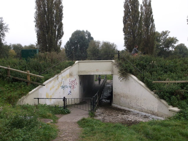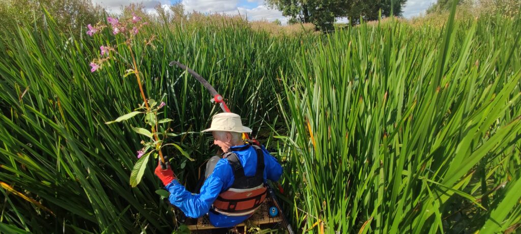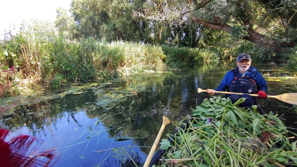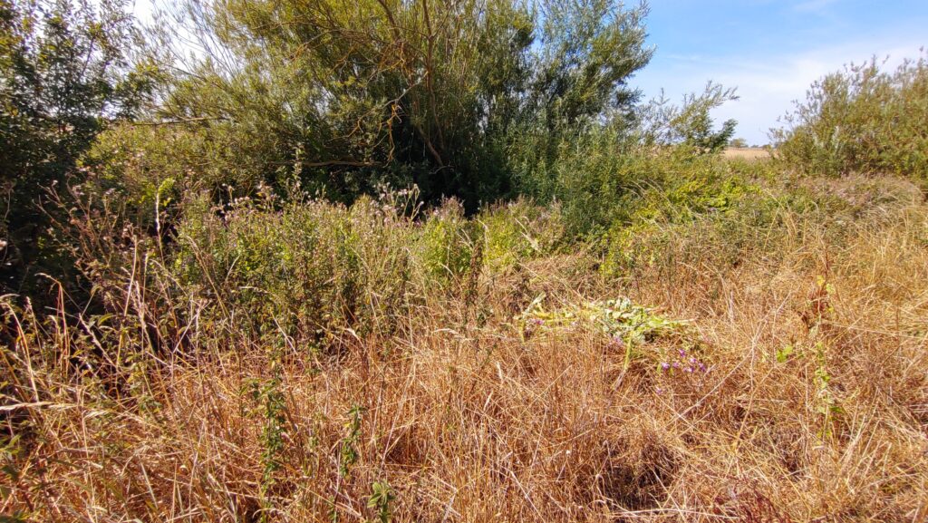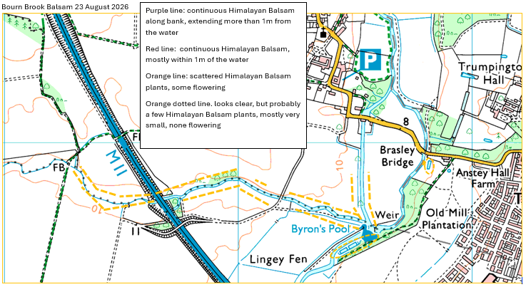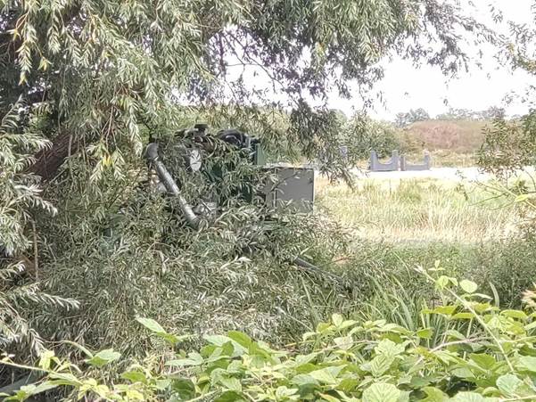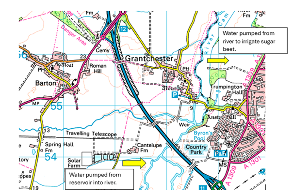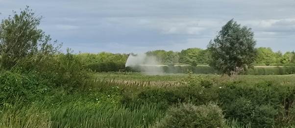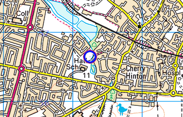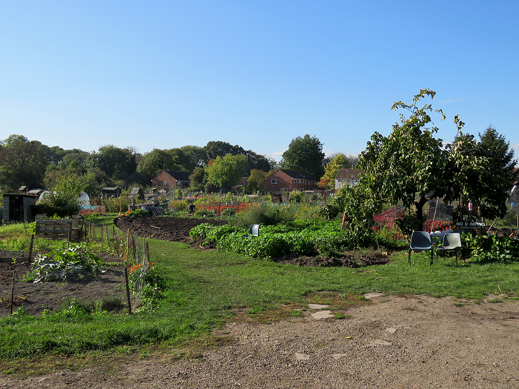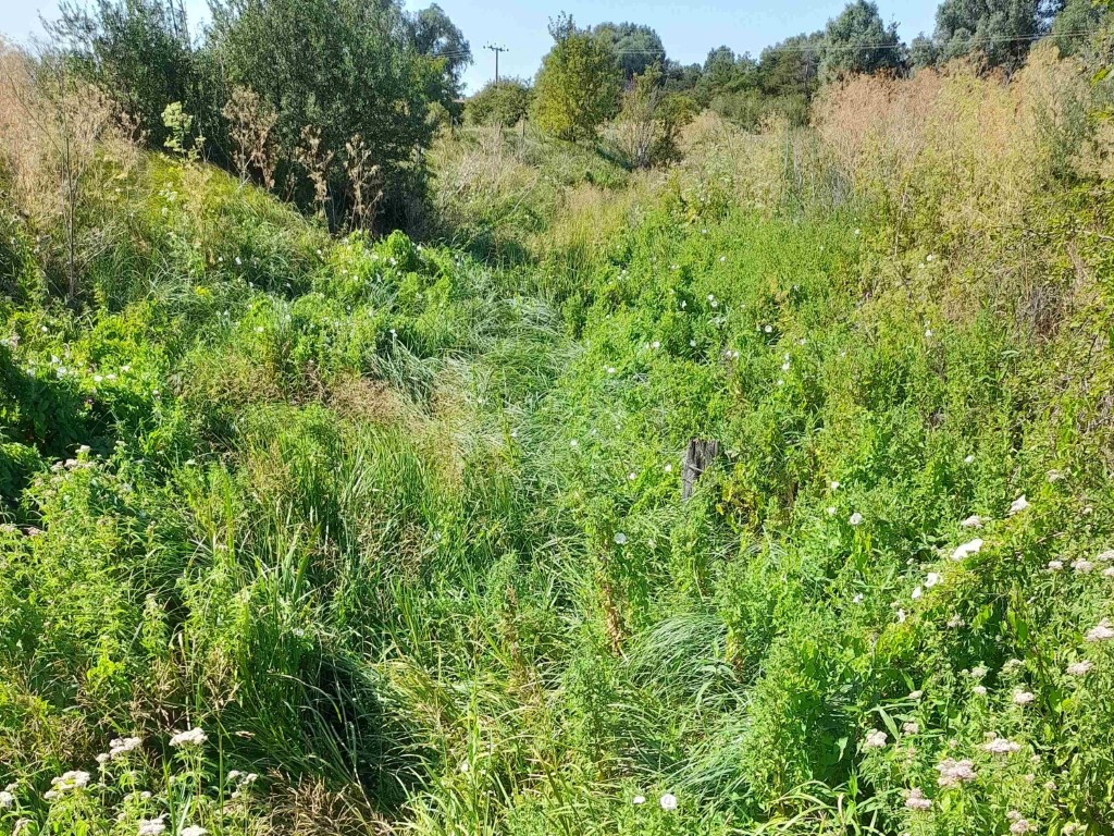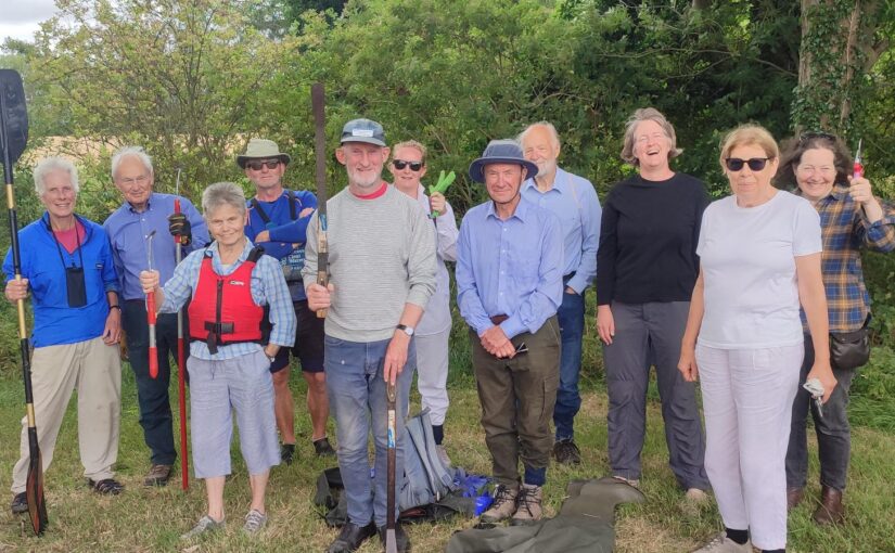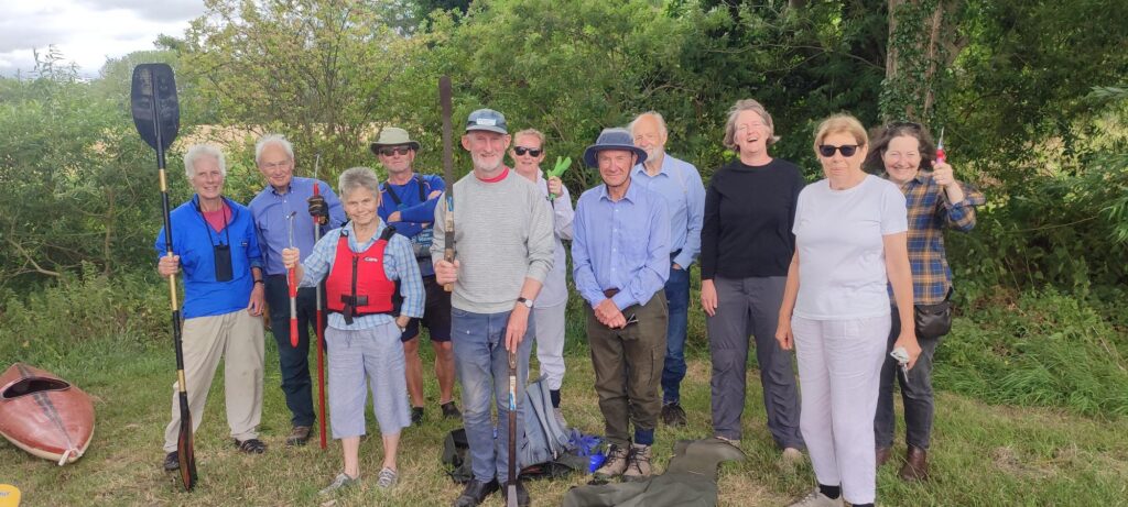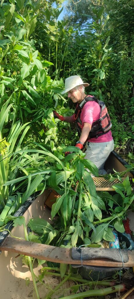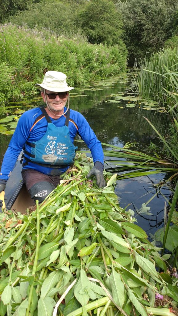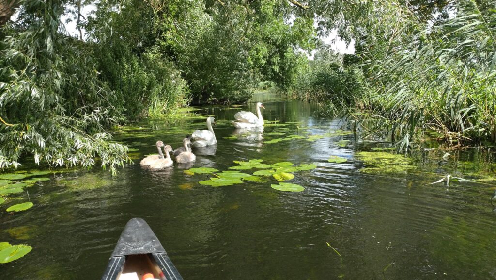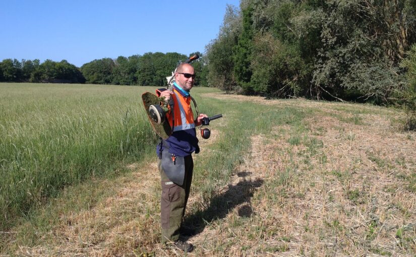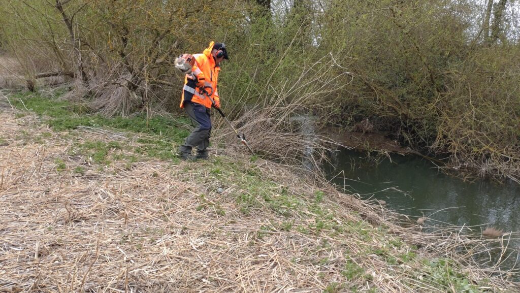
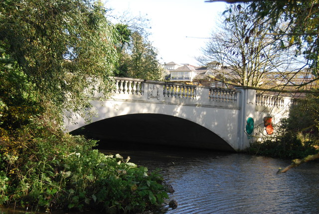
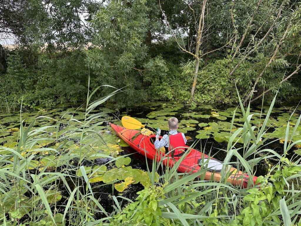
Our contractors, Gary and Reg came back on 26 May 2026 with strimmers to cut back the emerging Himalayan Balsam plants and nettles along Bourn Brook.
They did a great job, (starting at 5:45 am to beat the worst of the heat) on a blisteringly hot day when the temperatures reached 35C in the shade….
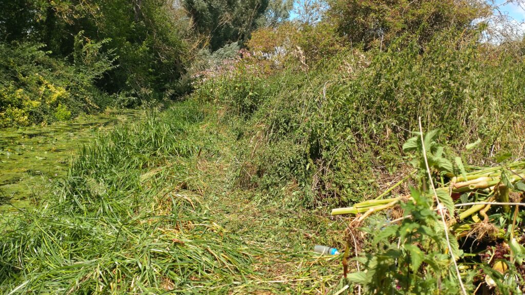
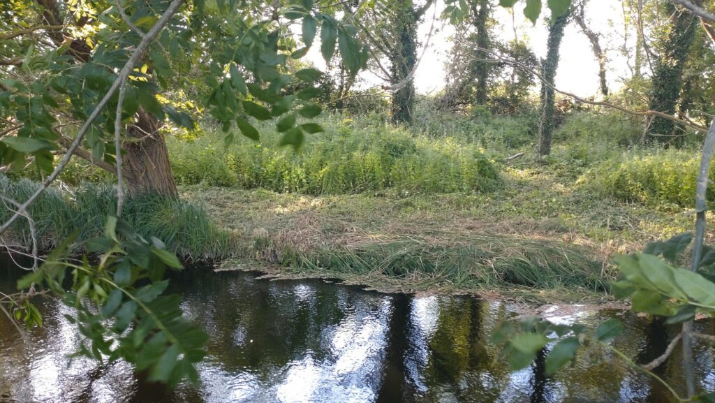
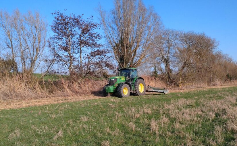
Trumpington Farm company had also helped by using their mower a few days earlier, so this minimised the amount they had to do beside the meadow on the South bank. That, in turn meant that they had time to cut back some of the balsam and nettles in the wood on the north bank too. This will make it much easier for volunteers to deal with the remaining balsam plants..
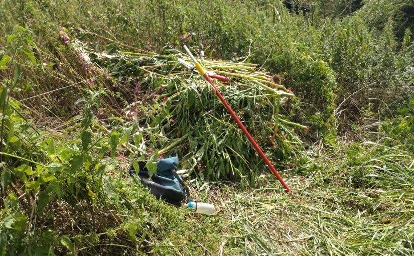
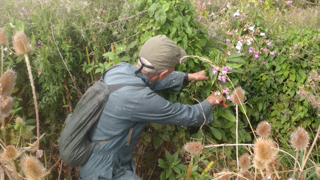
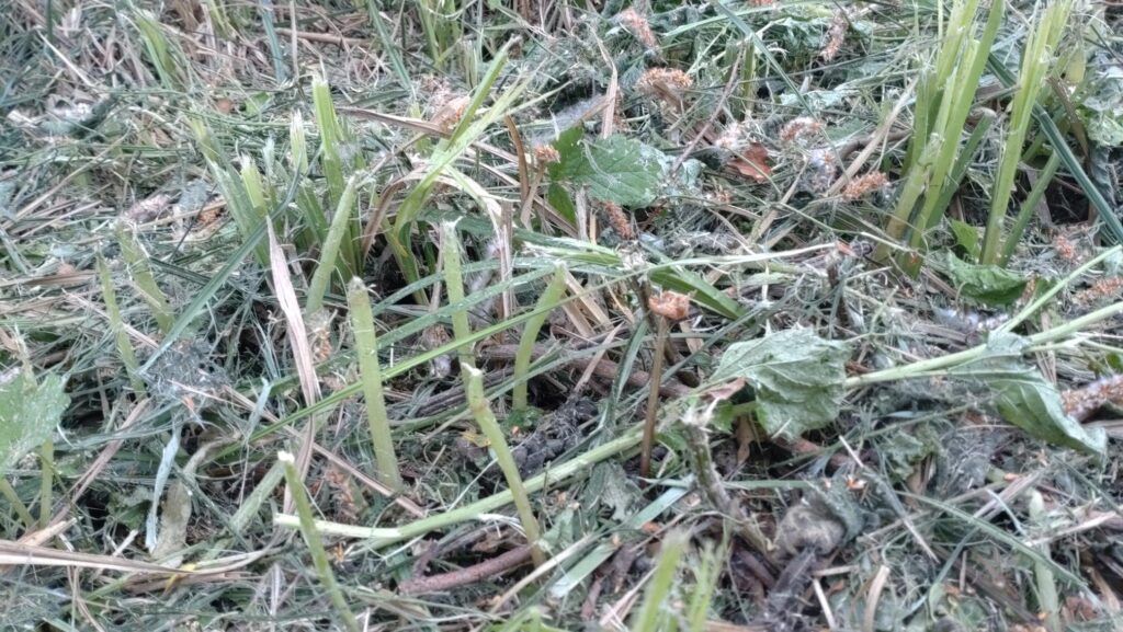
In the wood, there are a few plants that will probably need to be plucked out by hand before they re-sprout . (This is because some were cut above the first node .. If they’re cut below the first node they’ll die). However the Himalayan Balsam plants are now much easier to see, so this should be a relatively simple and pleasant task.
Pale green cut stems of young Himalayan Balsam plants.. these will need to be plucked out, or they will re-sprout
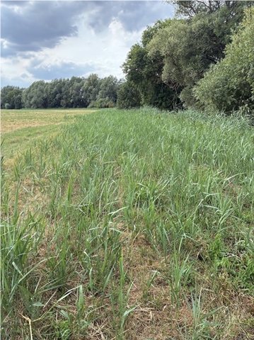
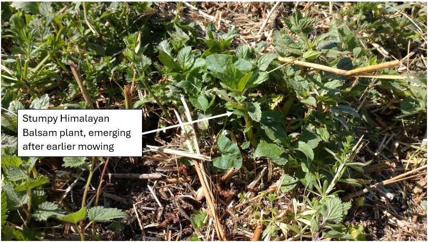
On the south bank, its worth looking out for the occasional clump of stumpy Himalayan Balsam plants, emerging after the mowing..
We’re planning the first working party on Sunday 5 July. Do let us know if you’d like to help. (Please note that this is private land, so access is only by arrangement with Trumpington Farm Company)
If you would like to help by spending a few hours pulling Himalayan Balsam in this beautiful spot this summer, do signup here, or email us on info@camvalleyforum.uk
30 years ago the River Rhee at Haslingfield was crystal clear but now its murky grey. Mike Foley and Anne Miller of Cam Valley Forum think they now know why.
Near Haslingfield 2016Near Haslingfield 2026
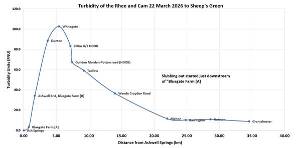
Mike has been monitoring the murkiness (known as turbidity) of the Rhee the source at Ashwell down to Clayhithe at intervals since 2022. (The Rhee is the branch of the Cam has its source at Ashwell, flows past Haslingfield to join the Granta or “Essex Cam” near Trumpington) The most recent results from 22 March 2026 show, as usual, a huge peak in turbidity just a few kilometres downstream of Ashwell. The murkiness of the water then steadily improved downstream, except for a small peak around Barrington/Haslingfield, and by Clayhithe it was once again pretty clear.
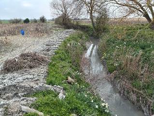
Mike says “We are confident that the peak in March 2026 in the upper Rhee is largely due to dredging that took place at Ashwell End from 28 January to about 7 February 2026. The effects are surprisingly persistent, lasting weeks or months and clearly visible far down the Rhee”
“My test result gave a peak turbidity of 100 FNU (NTU) which is shockingly poor. Visibility was no more than around 20cm”
Mike has recently discussed the problem with the farmer who is now more understanding of the consequences further downriver. Mike says, “However, we recognise that flood risk is a worry to farmers, and I hope that an alternative option to dredging can be found.”
Stephen Tomkins points out that “Natural Flood Management, which we want to see in the catchment is a huge component of contemporary Environment Agency thinking. The dredging should certainly stop”
In parallel with Mike’s on-the-ground investigations, Anne analysed data from the Environment Agency.
Anne says “I’ve analysed the historic data provided to us by the Environment Agency for the period 1980 – 2008. This shows that this is indeed true that the river has become more murky, particularly in the summer months. Prior to 2008, the Rhee at Haslingfield would often have appeared crystal clear, whereas today the visibility in summer is little more than 50cm.”
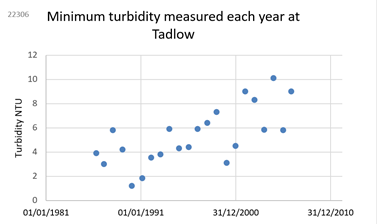
“The Environment Agency’s historical data also shows that upstream, at Tadlow, it wasn’t great, but it started to deteriorate further in the mid-1990s but by 2008 visibility would still have been around 1m. (That corresponds to an NTU of about 10).
“Environment Agency has also put real time monitoring systems in the river in three places, and given open access to the data. These transmit a result once an hour, 24/7, so I’ve been analysing the data looking for patterns. They have been extremely useful and we hope they can stay in place a bit longer.
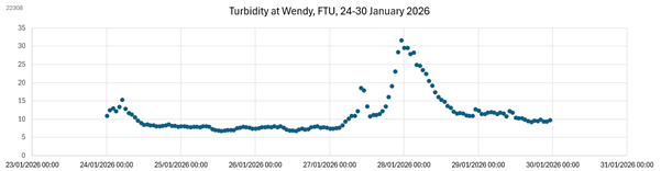
One can see huge peaks in turbidity after the start of upstream dredging in January and February this year.
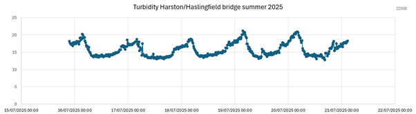
“But there is also evidence that American Signal Crayfish are active in summer, particularly around Haslingfield and upstream at Malton. We can see this in the data, because the turbidity is worst in summer nights, when they’re most active, burrowing and foraging in the riverbed.
One can also see their burrows in the riverbank, particularly around Haslingfield.
We wonder if the turbid state of the Rhee is due to an unfortunate combination of four factors:
Repeated dredging and slubbing-out of the upper reaches of the Rhee, aggravated by erosion of the clay riverbank, and field soils washing in from fields.
American Signal Crayfish. Initially this sediment may only have had local impact, but by 2011 American Signal Crayfish were frequently observed downstream of Barrington, and since 2018 they have been spreading upstream of Barrington. We suspect that their aggressive burrowing and foraging on the bed of the river is mobilising the fine clay sediment.
Modifications to Harston Mill Weir. Since March 2019, there has also been increased riverbed erosion and channel incision between Barrington and Harston, due to the modifications to Harston Mill Weir in March 2019.
The Local Geology. The upper Rhee, near its source at Ashwell, and in tributaries such as the Mill River have fine clay soils, and because of dredging and erosion the gault clay has now also become exposed in the riverbed much nearer to Cambridge, for example from Barrington to Harston.
Although it is impossible to change the local geology, this suggests three aspects to the solution.
Encourage the upstream famers to stop their dredging activities, and to protect field ditches from silting up.
Help stabilise the banks by ceasing herbicide use and reducing the shading (that has developed over the years) so vegetation can regrow and bind the soft banks.
Repair the damage caused by dredging. We understand that the best solution is to add gravel or aggregate, which then reduces further erosion of the stream bed.
These measures should produce a significant improvement in water quality by reducing turbidity.
As EastWestRail are planning to dig a tunnel near Haslingfield and build a bridge over the Rhee near Harston, we hope they can make a significant contribution to the cost of this work.
For some years, we’ve been trying to eradicate the Himalayan Balsam on the lower reaches of Bourn Brook. Although a pretty plant, it is highly invasive, so crowds out everything else. However, our problem has been that reeds and nettles have made it very hard to remove the Himalayan Balsam from the lower reaches of Bourn Brook, so its been quietly spreading… But we’ve now got help!
Pembrokeshire have a very useful advice leaflet, which includes the suggestion of using contractors to brush cut an area in early summer. They point out that this very substantially reduces the amount that needs to be hand pulled by volunteers, and “on a flood free site can get rid of most plants within a season”.
We’re excited about this idea, so earlier this year we raised the funds to engage contractors to help us by cutting back the reeds and nettles in advance of the main volunteer working parties.
We’d realised that we needed to start by cutting back the reeds, before the reed warblers arrive in mid April. The plan is that this will encourage them to make their nests a few hundred yards downstream, where they won’t be disturbed while we deal with the Balsam. They can then return next year (or the year after)
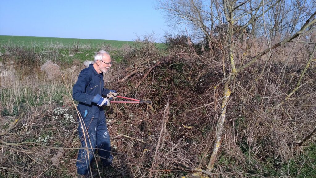
We started with a little preparation work in March 26, when volunteers cut back a bramble bush and piled up some fallen branches.
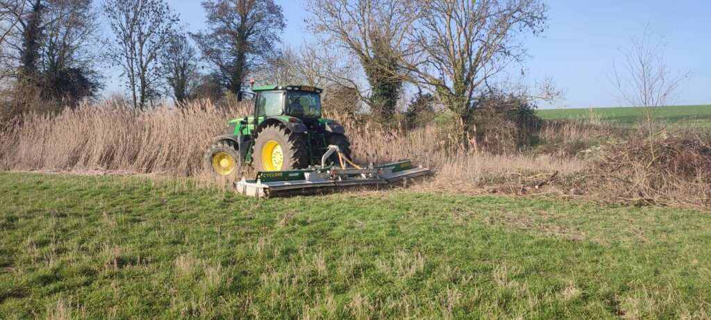
Trumpington Farm Company then kindly used their flail mower to cut what they could.
Then on March 24th 2026, our contractor (Gary, from MLP) worked hard for 2 days cutting back the more fiddly bits along the banks of the brook.
This created a delightfully clear meadow, all the way to the bank of the brook
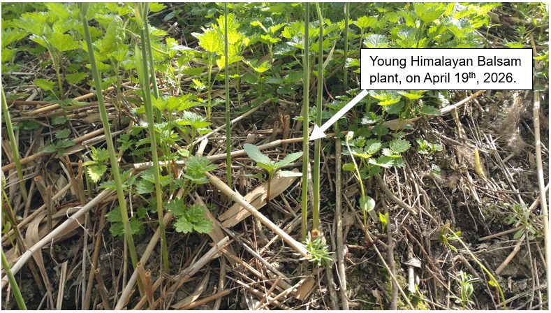
By mid April we could see tiny Balsam plants plants starting to emerge, ahead of the nettles. It was very satisfying pulling them out by the handful!…
We will be repeating the cut on May 26th, aiming to once again, remove all the nettles, reeds and Himalayan Balsam plants on the south bank of the brook. This should substantially reduce the amount that we need to do by hand. It should also make it much easier to see new Himalayan Balsam plants when they start to emerge from remaining seeds.
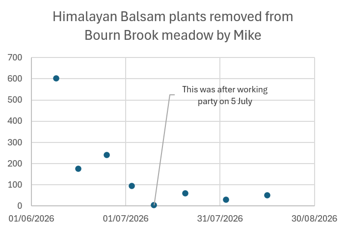
To “finish” the job, we plan to run volunteer working parties roughly monthly from June – October to pull up any newly emerging Himalayan Balsam plants…. With your help and persistence, this should go a long way towards eradicating Himalayan Balsam from this beautiful spot, just upstream of Cambridge.
If you would like to help by spending a few hours pulling Himalayan Balsam in this beautiful spot this summer, do signup here, or email us on info@camvalleyforum.uk
In February 2026, we were concerned to see a mysterious 4” hole gushing water under the eastern boundary fence from Haslingfield Sewage Works. This flowed into a ditch, then into the Rhee.
Despite the dry weather, the gusher was still flowing 10 days later. We were also concerned that the EDM storm overflow monitoring had gone offline on 24 February, having been previously showing an active storm overflow from 3 Feb- 23 Feb. Could these two things have been connected?
On 2 March 2026 we reported it to the Environment Agency and Anglian Water. We have also been investigating ourselves…
Our immediate concern was that it could be a leak from the Sewage works’ tanks, so we tested the “gusher” for E.coli. This showed that it had an E.coli of 4,500 /100ml. Although this is unhealthy, it was much less contaminated than the treated effluent from STW which had 29,000 E.coli/100ml. For comparison, Bathing water will be classified as “Poor” if the E.coli is occassionally > 900/100ml
When we reported it to Anglian Water they responded very quickly and bunged up the pipe. They tell us that it can’t be sewage, because the iron levels in the gusher were very low (0.05mg/l) and they dose all the incoming sewage with iron to remove phosphates. They said they suspect its surface water or a land drain. This seemed a bit improbable to us, but still….one has to keep an open mind….
The Environment Agency visited Haslingfield Sewage Works on 10 March, and reported back to us a few days later, saying:
“Our Officers attended site on 10 March and we identified that that the EDM monitor (records when the storm tanks are spilling to the environment) was situated in a channel with standing water (storm sewage) which means that the probe continued to be in contact with the water even when no discharge was taking place from the storm tanks. This resulted in false activations of the EDM monitor and was recording false ‘spills’ to the environment. The monitor has been taken offline for this reason, and AWS are scoping solutions to allow them to accurately record spills from the storm tanks
We also observed the small pipe as shown in the photographs attached to your email. The pipe comes directly from the boundary of the STW. This pipe has the appearance of a land drain. AWS Ltd bunged off the pipe, which led to water backing up on their site within cabling ducts and manholes. To alleviate this problem AWS are currently pumping the liquid that is backing up in the onsite manholes through the sewage works. AWS have tested this water, and it contains very low ammonia. It is possible that there could be a leak of final treated effluent wash water (used to wash screens etc.) that has made its way into the drain, or the water could be run off from farmland from beyond the site. AWS are going to conduct a drainage survey to try and determine where the liquid is coming from.
We went back to check progress on 22 March and 1 April. The orange bung was still in place, but a few meters to the left, another old pipe was now furiously dripping water. There was no visible surface water around, (and we could see through the fence that the storm tanks were empty) so where’s this water coming from? Is it a leak of Anglian Water’s “wash water” or could it somehow be ground water, despite the dry weather?
Looking around the site we spotted that there was a field drain emerging from the field just at the north east corner of the Sewage works.
Despite the dry weather this was flowing vigorously..
It seemed bizarre that so much water was coming out of an apparently dry field, so what was going on? Could it possibly be that springs have formed there? Or is it just that the fields still haven’t dried out at the depth of the field drain?
We’ve been told that since the nearby Cemex cement works at Barrington closed in 2008, and stopped abstracting water from the aquifer, various new springs have started forming in the area.
I did a bit of digging into historic maps available from the National Library of Scotland and Wow… The 1956 map marks a Spring, exactly at the site of the sewage works that was built a few years later
Today, this seems a really dumb place to have chosen for a sewage works, but in the late 1950s, could it have been deliberately sited there so the spring water would help wash out the treated sewage?
And today, is a re-emerging spring responsible for the water that’s now accumulating in Anglian Water’s cable ducts and manholes, escaping off-site through long-abandoned field drains? And could a re-emergent spring line be causing the subsidence in Anglian Water’s channel that were told about in 2021, so that the EDM sensors are once again sitting in a puddle, giving the false impression that there’s a storm overflow in progress?
Whoever it was that chose the site, this is now a problem for Anglian Water to fix..
The formal AGM was followed by a brief review of the last 25 years, a celebration cake, and the annual lecture by Alison Matthews, Chalk Stream Programme manager at The Rivers Trust. You can see some photos, and download the presentions below
The minutes of the formal AGM are available here [to be added]
Anne then showed 10 slides in 200 seconds, illustrating some key activities and achievements over the last 25 years. You can download the slides here
This was followed by Cllr Katie Thornburrow saying a few words about how important Cam Valley Forum’s work has been and ceremonially cutting a celebration cake.
The cake (a vegan carrot cake) was made for us by Arjuna Wholefoods and funded by the committee: it was both delicious and a work of art!
After the break, Alison Matthews, Chalk Stream Programme Manager at The Rivers Trust, gave a fascinating presentation on Finding a way to protect and restore our Chalk Streams
Cam Valley Forum committee member, Michael Goodhart was pleased to represent Cam Valley Forum in Parliament on 25 February 2026, supporting Pippa Heylings, the MP for South Cambs, as she presented her private members bill campaigning to protect our Chalk streams with UNESCO World Heritage Status
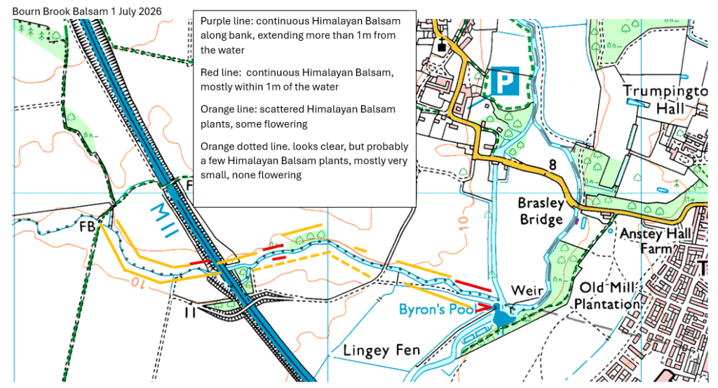
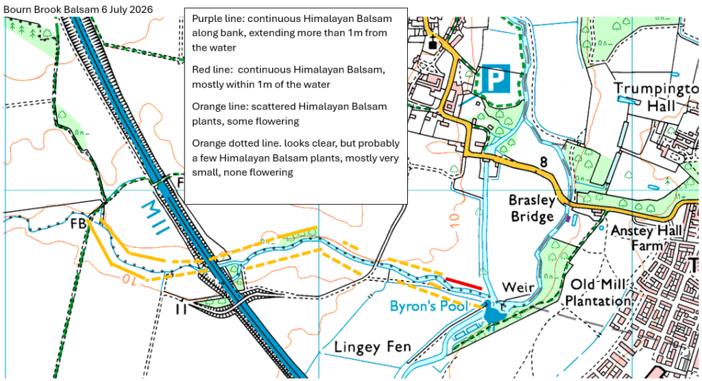
You can read the full text of her inspiring speech here and watch it on YouTube here Note the reference to Cam Valley Forum.
She started her speech by saying:
“I beg to move, that leave be given to bring in a Bill to require the Secretary of State to take the necessary steps to nominate the UK’s chalk streams as a serial UNESCO Natural World Heritage Site.
My Bill concerns a rare natural resource of universal value. We in the UK are custodians of 85% of the world’s chalk streams, our equivalent of the Great Barrier Reef. They are timeless jewels of our natural heritage, yet we are allowing them to be drained dry and to have raw sewage dumped on them by water companies that put profit before people and the planet. My Bill would ensure that we finally give chalk streams the same reverence and protections that we give to our greatest cathedrals or monuments. Our streams and rivers are just as much a part of our national identity and international significance.….”
“…….In my constituency—here with us in the Gallery—there are the Cam Valley Forum, the Cam Catchment Partnership, the friends of the River Shep, the Granta and Fulbourn Fen, and the Cambridgeshire climate and nature forum.“
She finished by saying
“That is why I am joining many voices in calling for the listing of chalk streams, alongside ancient woodland, as irreplaceable habitat, which they certainly are, in the national planning policy framework, in line with the Government’s concession and promise during debate in this Chamber to
“make clear, unambiguously, our expectations for how plan makers and decision makers should treat chalk streams.”—[Official Report, 13 November 2025; Vol. 775, c. 407.]
We should also be ringfencing substantial financing from the water restoration fund.
As a nation that prides itself on its love of nature and is preparing to celebrate the 100th birthday of nature’s greatest advocate, Sir David Attenborough, we have a responsibility to act. It is a global responsibility handed to us by the rocks beneath our feet. Let us embrace it and celebrate it. Let us be the global custodians of our very own equivalent of the Galapagos Islands, the Great Barrier Reef and the rainforest. This Bill would start the journey to secure UNESCO recognition for one of the rarest habitats on Earth. We hold 85% of the world’s chalk streams. With that privilege comes responsibility. Let us rise to it. I commend the Bill to the House.“
How to help the campaign to get Unesco recognition for chalk streams:
The consultation on the National Planning Policy Framework, is available here. Deadline 11:45pm 10 March 2026. Do respond to the consultation, calling for chalk streams, alongside ancient woodland, to be listed as irreplaceable habitat.
If you’d like to help in other ways do get in touch with us via info@camvalleyforum.uk
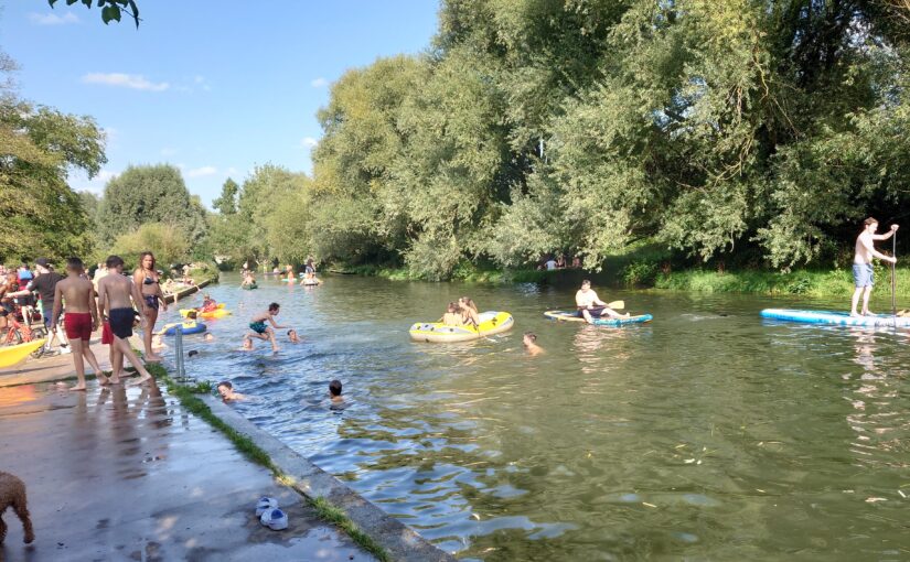
It’s interesting to compare the results from the water quality monitoring that we, and the Environment Agency have been carrying out at Sheep’s Green in the 2024 and 2025 bathing seasons
The graph above shows the Environment Agency results for E.coli at Sheep’s Green in red, Cam Valley Forum’s results in green, and the rainfall in blue. (Click here for a larger copy of the graph)
The Bathing Water Quality during the 2024 season was rated as “Poor”, with ALL readings above the threshold of 900 E.coli/100ml. (Although the actual way of calculating the classification for the season is quite complicated, if more than a few test results are above 900 E.coli/100ml, the classification for the season is likely to be “Poor. This webpage explains it in more detail)
Encouragingly for swimmers, during the 2025 season, the water quality was mostly well within the “Good” range often having just 200-300 E.coli/100ml. However the overall classification was still “Poor” because of a few very high readings.
We wondered if Anglian Water had done anything to cause this improvement, but they tell us that they think it is just because it rained less….
The graph above shows rainfall as a blue line and its clear it was a bit wetter in 2024 than 2025. Looking at the source data, we note that it rained for an average of 2mm/day in the 2024 “bathing season” but only 0.7mm/day in the 2025 “bathing season”.
Do join us for our 2026 AGM and help celebrate our 25th Anniversary. This will be followed by our Guest Speaker, Alison Matthews, Chalk Stream Programme Manager, The Rivers Trust on ‘Finding a way to protect and restore our Chalk Streams‘
Celebration with cake at 7.30pm, to celebrate Cam Valley Forum’s 25th Anniversary
Annual Lecture ~8.00 pm
Annual Lecture: Finding a way to protect and restore our Chalk Streams
Alison Matthews, Chalk Stream Programme Manager at The Rivers Trust will outline the current national policy and legal framework for chalk stream protection and recovery, and share some thoughts about the various government strategies and the challenges.
She will also share some inspiring stories about positive case studies on our chalk streams
About Alison Matthews
Chalk streams have run through Alison’s 30 year career in the environmental sector and so she was delighted to be appointed to manage implementation of the Chalk Stream Restoration Strategy in April 2024. Working for many years in Hampshire as a water resources specialist, Alison understands the pressures facing chalk stream salmon in the iconic Test and Itchen rivers. Working across organisations, she hopes to bring people together to unite them in delivering the ambition of the Rivers Trust to deliver wild, healthy and natural rivers valued by all.
A Portrait of the Cherry Hinton and Coldham’s Brooks
Judging by the interest shown in the CVF 2025 Summer Walk along Coldham’s Brook, readers may be interested in the fascinating ‘portrait’ found on the website of the Friends of the Cherry Hinton and Coldham’s Brooks here
Though the article ranges from the Cherry Hinton Hall vanity project c. 1839 to the unfamiliar activities in 1852 of The Cambridge University and Town Waterworks Co. at Giant’s Grave, and the historical Cherry Hinton Brook channel dredging debacle, not to mention the devastation caused by industrialisation, the Summer Walk followed what must be the very saddest tributary of the Cam, further downstream, the Coldham’s Brook.
It can be conceded that most of its water eventually reaches the Cam but not as a tributary in the conventional sense. It is not a happy state of affairs. To cut to the chase see the six maps in the Appendix.
On 2 December 2025 Mike Foley of Cam Valley Forum’s (CVF) Mike Foley presented a talk on river turbidity and its most probable causes at Newnham Croft Social and Sports Club, to an audience with a wide range of interests.
The slides are available here. They have been edited to provide a little more of the details presented verbally at the talk, and this Blog accompanies the slides from the talk. (It is illustrated with a few of the slides, but we recommend you look at the full set of slides too)
The investigations into turbidity were separate from CVF’s monitoring along the Cam and Rhee of faecal indicator bacteria from 2021 which focused on trying to locate the main sources of the organisms. We now know these enter the river continually in fairly high numbers in the discharged, treated effluent at Haslingfield sewage treatment works, and from other locations.
If you have no time to read further, Mike’s conclusion is that soil in suspension is the most probable reason for the turbidity. Downstream of Wendy into Cambridge, turbidity is further exacerbated by the presence and activities of the non-native, invasive American Signal Crayfish, now present in large numbers. The clayey nature of the soil type along the Rhee is one important factor in this river being far more turbid than others in the Cam Catchment.
We suspected this all along, but for reasons that will unfold, we thought it was necessary to investigate other causes. Past dredging, upstream of Wendy, is implicated.
The history
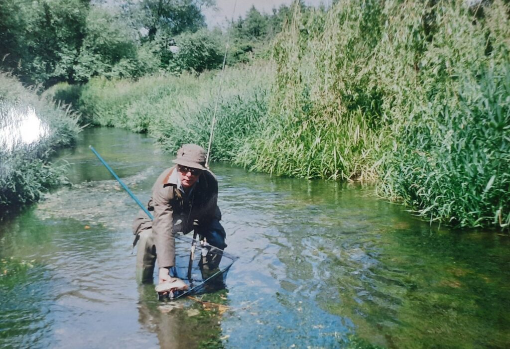
Turbidity is the formal name for murkiness or cloudiness of water. A former CVF committee member and angler Alan Coulson noted in 2015 that something wasn’t right with the Cam. He photographed the Cam at Hauxton Junction where the Essex Cam, also known as the Granta, joins with the Rhee. The Rhee was very murky whereas the Essex Cam / Granta seemed clear.
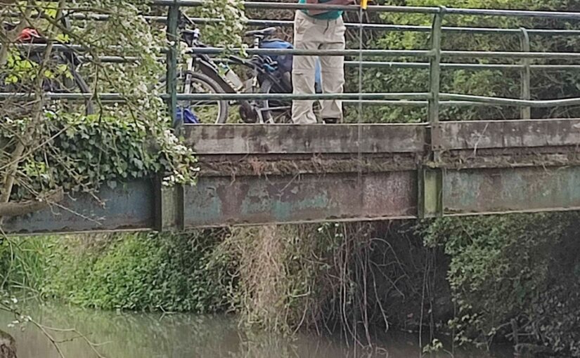
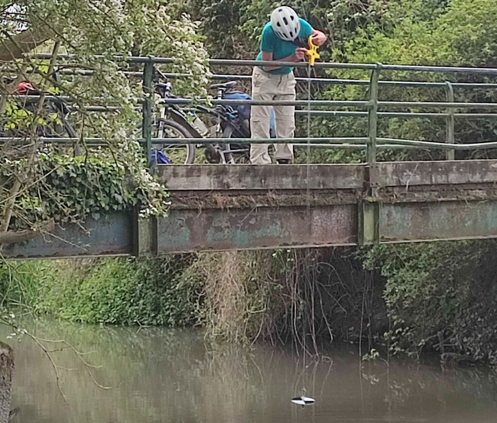
In early 2022 while Mike was sampling for faecal bacteria and nutrient levels, he realised that lowering the shiny rake vertically into the water was a simple way to measure “depth to invisibility” (DTI). In other words, he could measure how far down he needed to lower the rake until the head became just invisible. He enthusiastically built up a dataset of DTI from various sites over the year and into 2023. When there were sufficient readings from the Byron’s Pool part of the Cam (actually Brasley Bridge) he sorted the results according to low flow and higher flow conditions. Spookily, at low flows, i.e. low-summer flows, turbidity increased as flow decreased. This did not suggest a specific cause but was a good point to start considering options.
Soon, Mike was using a Secchi tube, extended to 165cm length to capture low turbidity events. He also occasionally used the nephelometer Hanna HI-93703 and the Hanna Multiprobe HI-98594, loaned from Hobson’s Conduit Trust, with thanks to Dr Steve Boreham for maintaining their calibrations.
How turbid are the Rhee and Cam?
Several monitoring excursions in 2025 have clearly shown that the Rhee is clear at its source in Ashwell, but turbidity can reach very high levels in the upper Rhee, peaking around Whitegates Bridge/ Potton to Guilden Morden road/Tadlow (94 FNU at Tadlow on 20 May 2025). Turbidity then reduces downstream. On the same day, Byron’s Pool’s reading was 25 FNU, but still obviously turbid. Turbidity in summer can rise slightly at further sites around the Haslingfield-Harston road bridge. It is then slightly lower at Byron’s Pool, lower still at Sheep’s Green and very low at Clayhithe.
(Note that NFU “Nephelometric Turbidity Unit” and DTI “depth to invisibility” relate to two different ways of measuring turbidity. A large NFU value (as shown in the graph) indicates high turbidity, whereas a large DTI “Depth to invisibility”, as used elsewhere on this website, implies clearer water)
Local farmers around Tadlow recall the Rhee was clear only a few years ago. Photographs taken in October 2012 near Harston reveal the Rhee appeared clear then, in contrast to its high turbidity of the past few years.
Phosphate / sewage pollution
In 2022, WASP (Windrush against Sewage Pollution) reported, “One common feature of the rivers suffering turbidity issues is sewage pollution and a potential link with high phosphate inputs from STWs.” Could these be a major cause of our turbidity? The answer seems to be no.
For instance, the highest turbidity in 2025 was measured along the Rhee near Tadlow where CVF sampling showed that stretch had the lowest phosphate (<0.084 mg/l) of the entire river. Furthermore, CVF monitoring of the Rhee and Cam for phosphate in 2021/2022 from Harston showed no decrease in concentration at the lowest part of the Cam we monitored – Clayhithe (mean of three samples, 0.442 mg/l orthophosphate-P). Yet Clayhithe had the clearest water of the entire Cam.
There exists a particulate whitish chemical called “Struvite” which contains phosphate. This forms when there are equi-molar amounts of ammonium, magnesium and phosphate present – MgNH4PO4.6H20 – and it can form at sewage works. Routinely Mike sampled effluent at several works and using either a Secchi tube or nephelometer, and if struvite was present in sufficient amounts it would show up. One sampling at Haslingfield STW on 30 April 2025 coincided with a storm overflow, and resulted in the following turbidity readings (FNU): (a) treatment using filtration beds, 5.15. (b) treatment using the activated sludge tank, 1.07. (3) pure storm overflow from storm tanks, 7.45. These readings show that the effluent turbidity so far too low to be a contributor, on that occasion. Furthermore, Mike has compiled readings that show effluent at other works can be remarkably clear, though there is usually some small amounts of natural brown particulate matter present, called “floc”, that is part of the treatment process. For instance, Melbourn and Linton STW effluent can be so clear that after filling the entire 165cm long Secchi tube with effluent the Secchi disk at the base of the tube is still visible.
Thus, treated sewage (also the storm overflow above) at the numerous Anglian Water sewage works discharging into the Rhee, Cam or tributaries appear not to contain sufficient particulates to contribute to high river turbidity.
Nor do measurements of the effluent reveal levels of bacteria high enough to cause a turbid “soup”. Also, it’s not in the nature of naturally occurring aquatic true bacteria in a flowing river to form soups sufficiently turbid to explain what we have been seeing.
Algal blooms
Cyanobacteria (blue-green algae) can create turbidity – this has occurred recently at Todd’s Pit at Milton Country Park – but high power microscopical examination of Rhee water show no cyanobacteria in large numbers.
In recognition that the Cam sometimes appears green, a Turner Aquafluor detector of green algal Chlorophyll a was loaned in 2024 from the Zoology Department, Cambridge University. Samples from sites on the Rhee and Cam where the water was grey-brown were found to have zero amounts of Chlor a. No river samples were green.
Suspended soil
Soil appears to be the culprit. It cannot be coincidental that the colour of the arable soils in the upper Rhee and the Rhee banks have some greyish hue in them that matches the colour of the river water in the summer. Mike has passed on samples to Dr Steve Boreham of WildReach.co.uk who confirms that they contain soil. However, it is not all soil – there is also some organic matter and particulate calcium carbonate.
It seems that only small amounts of soil are needed to create turbid conditions. It could be soil resuspended from the river bed, etched out of the bank, or newly arrived via arable ditchworks or directly from fields into the river. The puzzle still to solve is how turbidity in the upper Rhee persists during periods of dry conditions when ditches are dry and there is no runoff from fields. It appears that only small amounts of soil released into the water are needed to make the river turbid.
It seems reasonable to ponder that suspension of extremely fine clay into the water at one point will not persist too far downstream. Perhaps it is only 50m, depending of soil particle size. But if uplift is happening at one point, it will also be happening a little further downstream, but from this second point the soil will be carried a little further on, and so on.
A controversial issue is the dredging of the Rhee to reduce the risk of overtopping during high winter rainfall. Dredging may expose fresh layers of clay that can lift more easily into the water.
American Signal Crayfish
In 2023, Mike saw persistent high turbidity in the Cam during the summer when for weeks there was no appreciable rainfall to drive soil from ditches or arable fields into the river. The tributary Bourn Brook was actually fairly clear compared to the Cam and thus not a major contributor. Some Chalk streams were slightly turbid but not enough to increase turbidity of the Rhee and Cam. In fact, they would be diluting the turbidity
The simple answer to turbidity in dry spells seems to be American Signal Crayfish. This invasive crayfish has been shown markedly to increase turbidity. Populations can be large: over 1600 crayfish of all sizes and age were taken out of a Yorkshire beck headwater just from a 10m stretch. Largely active nocturnally they stir up bed sediment while fighting and feeding, and when capturing and eating juveniles, and tunnel into the bank up to 200cm depth (mostly up to 60cm on the fish pass at Byron’s Pool). The excavations must allow continuous suspension of soil, whilst mature tunnels cause erosion, sometime causing bank collapse.
The Environmental Agency has concluded that that the turbidity of both the Windrush and parts of the Rhee involves the presence of American Signal Crayfish.
Mike has noted increasing turbidity in the Granta and the Essex Cam / Granta at Hauxton Mill. Crayfish are populating more stretches of our rivers (and are common at Hauxton Mill) and as tagging has shown that they can march 100m upstream overnight, he foresees invasion forces moving steadily towards the headwaters. Numbers may be very low at the front of the invasion – however, it has been proposed that only one female and one male need to be present in stretch of 200m if the stream is 5m wide to be the Minimum Viable Population Density, usually undetectable. Over future years we will see more colonisation, and probably therefore even higher turbidity levels where the geological base of the soil in that stretch is of the right type to be suspended.
Conclusions
No evidence that the prolonged turbidity is caused by algal blooms
Not obviously sewage works related
Not a direct phosphate effect
Upper Rhee – probably soil alone
Lower Rhee and Cam – soil + American Signal Crayfish
The geological soil type seems pivotal in determining how turbid the water becomes from soil suspension.
Local farmer perceptions reveal the upper Rhee was not nearly so turbid just a few years ago. Some light dredging in the upper Rhee may be part of the cause.
Actions
Reduce soil runoff from arable fields into ditches or direct into the rivers
Discontinue any dredging of the rivers (when possible)
Reinforce bank sides
Need for scientists to devise a control measure for the crayfish
Trapping of crayfish to reduce populations needs to be thorough and not just removal of adults. A near-impossible task on large stretches of the Rhee and Cam.
Testing of the upper Rhee with environmental-DNA specific to American Signal Crayfish to determine how much of the Rhee around Tadlow it has colonised.