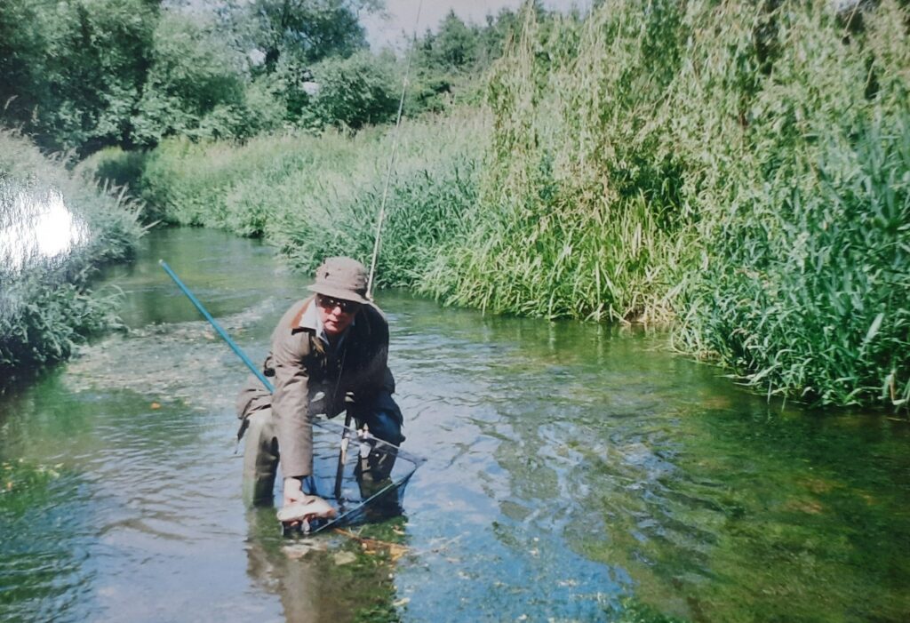
30 years ago the River Rhee at Haslingfield was crystal clear but now its murky grey. Mike Foley and Anne Miller of Cam Valley Forum think they now know why.
Mike has been monitoring the murkiness (known as turbidity) of the Rhee the source at Ashwell down to Clayhithe at intervals since 2022. (The Rhee is the branch of the Cam has its source at Ashwell, flows past Haslingfield to join the Granta or “Essex Cam” near Trumpington) The most recent results from 22 March 2026 show, as usual, a huge peak in turbidity just a few kilometres downstream of Ashwell. The murkiness of the water then steadily improved downstream, except for a small peak around Barrington/Haslingfield, and by Clayhithe it was once again pretty clear.
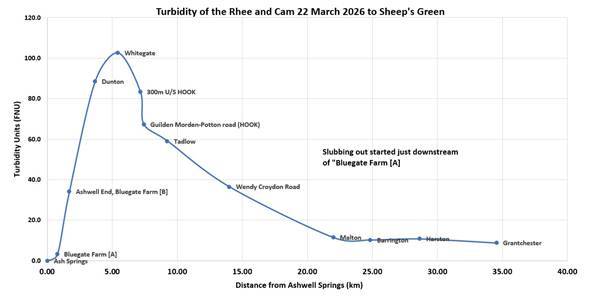
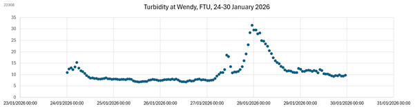
Mike says “We are confident that the peak in March 2026 in the upper Rhee is largely due to dredging that took place at Ashwell End from 28 January to about 7 February 2026. The effects are surprisingly persistent, lasting weeks or months and clearly visible far down the Rhee”
“My test result gave a peak turbidity of 100 FNU (NTU) which is shockingly poor. Visibility was no more than around 20cm”
Mike has recently discussed the problem with the farmer who is now more understanding of the consequences further downriver. Mike says, “However, we recognise that flood risk is a worry to farmers, and I hope that an alternative option to dredging can be found.”
Stephen Tomkins points out that “Natural Flood Management, which we want to see in the catchment is a huge component of contemporary Environment Agency thinking. The dredging should certainly stop”
In parallel with Mike’s on-the-ground investigations, Anne analysed data from the Environment Agency.
Anne says “I’ve analysed the historic data provided to us by the Environment Agency for the period 1980 – 2008. This shows that this is indeed true that the river has become more murky, particularly in the summer months. Prior to 2008, the Rhee at Haslingfield would often have appeared crystal clear, whereas today the visibility in summer is little more than 50cm.”
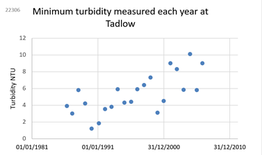
“The Environment Agency’s historical data also shows that upstream, at Tadlow, it wasn’t great, but it started to deteriorate further in the mid-1990s but by 2008 visibility would still have been around 1m. (That corresponds to an NTU of about 10).
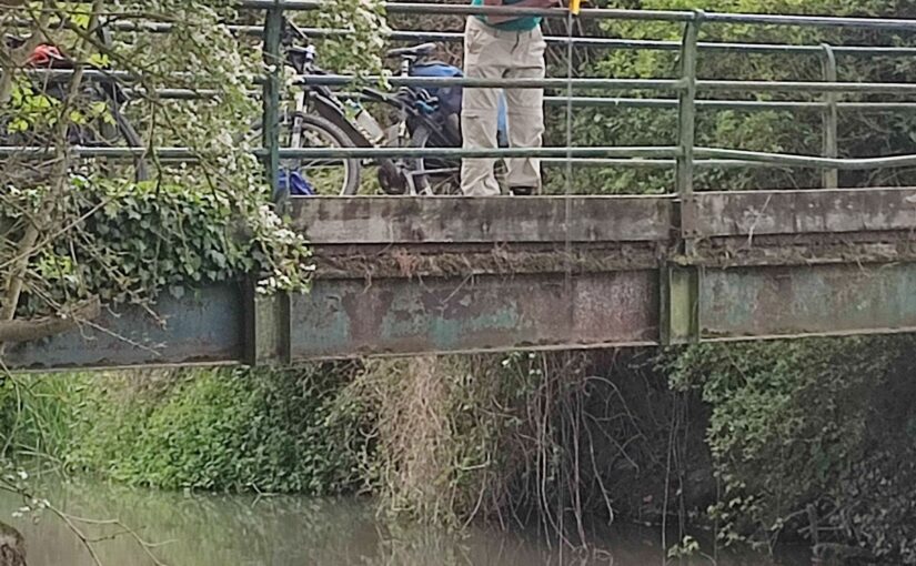
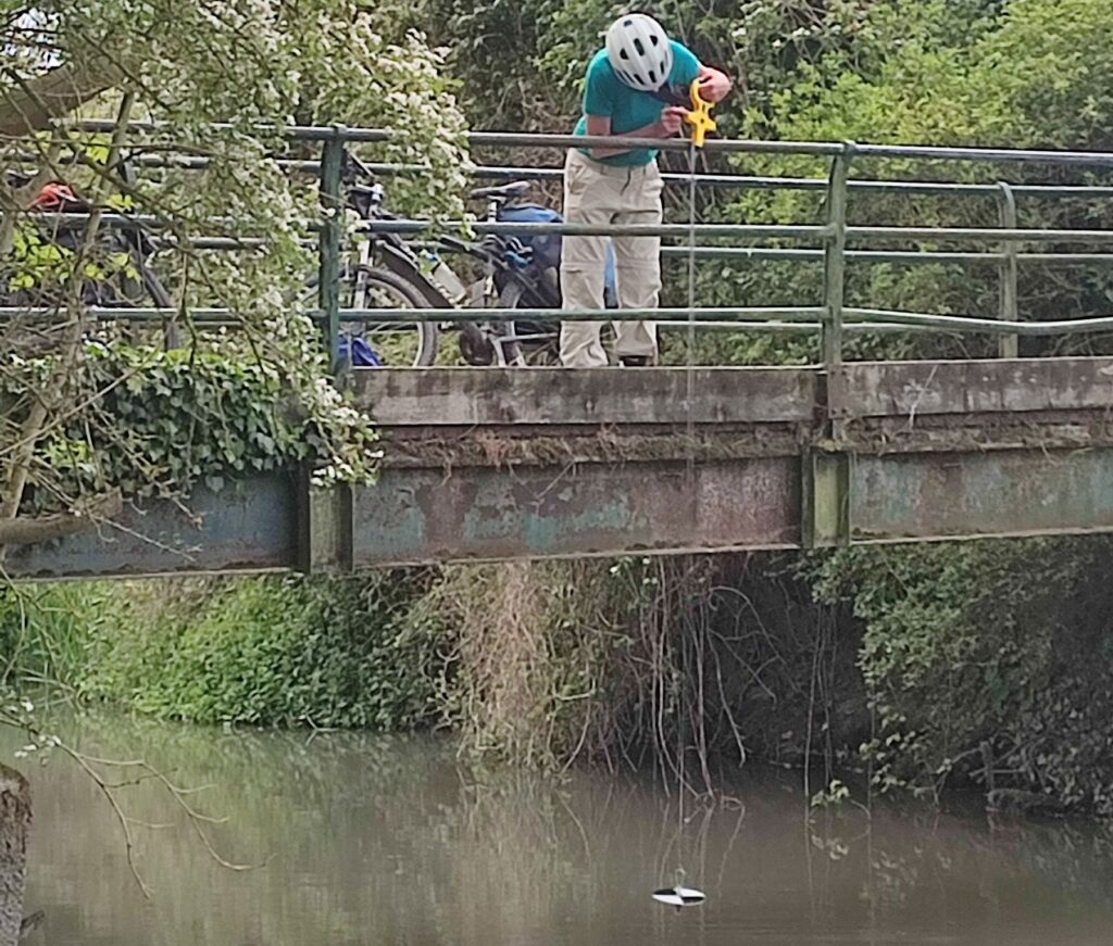
“Environment Agency has also put real time monitoring systems in the river in three places, and given open access to the data. These transmit a result once an hour, 24/7, so I’ve been analysing the data looking for patterns. They have been extremely useful and we hope they can stay in place a bit longer.
One can see huge peaks in turbidity after the start of upstream dredging in January and February this year.
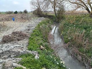
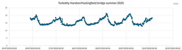
“But there is also evidence that American Signal Crayfish are active in summer, particularly around Haslingfield and upstream at Malton. We can see this in the data, because the turbidity is worst in summer nights, when they’re most active, burrowing and foraging in the riverbed.
One can also see their burrows in the riverbank, particularly around Haslingfield.
We wonder if the turbid state of the Rhee is due to an unfortunate combination of four factors:
- Repeated dredging and slubbing-out of the upper reaches of the Rhee, aggravated by erosion of the clay riverbank, and field soils washing in from fields.
- American Signal Crayfish. Initially this sediment may only have had local impact, but by 2011 American Signal Crayfish were frequently observed downstream of Barrington, and since 2018 they have been spreading upstream of Barrington. We suspect that their aggressive burrowing and foraging on the bed of the river is mobilising the fine clay sediment.
- Modifications to Harston Mill Weir. Since March 2019, there has also been increased riverbed erosion and channel incision between Barrington and Harston, due to the modifications to Harston Mill Weir in March 2019.
- The Local Geology. The upper Rhee, near its source at Ashwell, and in tributaries such as the Mill River have fine clay soils, and because of dredging and erosion the gault clay has now also become exposed in the riverbed much nearer to Cambridge, for example from Barrington to Harston.
Although it is impossible to change the local geology, this suggests three aspects to the solution.
- Encourage the upstream famers to stop their dredging activities, and to protect field ditches from silting up.
- Help stabilise the banks by ceasing herbicide use and reducing the shading (that has developed over the years) so vegetation can regrow and bind the soft banks.
- Repair the damage caused by dredging. We understand that the best solution is to add gravel or aggregate, which then reduces further erosion of the stream bed.
These measures should produce a significant improvement in water quality by reducing turbidity.
As EastWestRail are planning to dig a tunnel near Haslingfield and build a bridge over the Rhee near Harston, we hope they can make a significant contribution to the cost of this work.
For further information, read the full report “The Mystery of the Murky Rhee” here https://camvalleyforum.uk/publications/