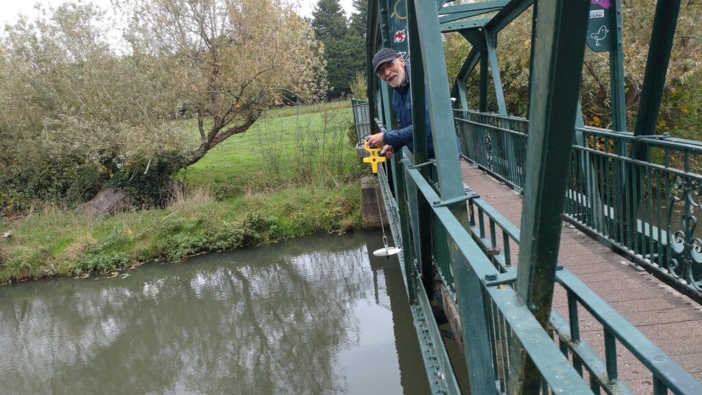
As part of our investigations to understand why the Cam is so murky (technically known as “turbid”) we are monitoring the turbidity at Sheeps Green, roughly every month.
As the Cam is quite deep here, we do this using a “Secchi disk”, measuring the depth at which the black and white segments are no long distinguishable. This is called the “Depth to Invisiblity” or DTI.
The results are shown on the chart here. The greater the “Depth to Invisibility” (DTI) the clearer the water.
We know that the turbidity is mostly due to suspended soil and fine clays. All readings are taken when the Cam is flowing gently (ie not in flood) so we hope that the results may help indicate whether the primary cause is agricultural or the burrowing of the invasive American Signal Crayfish.
American Signal Crayfish are most active in the summer, but inactive in their burrows during the winter. If they were a primary cause of the turbidity, one might expect it to be worse in the summer (ie DTI readings to be lower)
If agriculture was the problem, it might be expected to be worse in the winter, when there was less vegetation on fields to retain the soil.
You can read more about our investigations on the rest of the river here .
As the graph below shows, in May 2025 Turbidity was worst in the area of Guilden Morden, possibly because of upstream farmers “improving” the drainage on their fields. It then steadily improved downstream, except for the Barrington / Haslingfield area. This apparent subsidiary “peak” in turbidity might possibly be due to the huge numbers of American Signal Crayfish in the Barrington / Haslingfield area
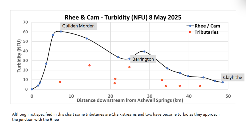
Note that NFU and DTI “depth to invisibility” relate to two different ways of measuring turbidity. A large NFU value (as shown in this graph) indicates high turbidity, whereas a large DTI “Depth to invisibility”, as used in our readings at Sheeps Green, implies clearer water. An NFU of 10 is roughly equivalent to a DTI of 1m